Hokkaido in 30 Days by Campervan: A Slow Loop, 200 km a Day Max, RV Parks Every Night (Jul–Aug) [2026]
A 30-day clockwise loop around Hokkaido from New Chitose Airport: about 3,104 km, no day over 196 km, an RV park or auto campsite every night (July–August).
With 30 days, you can drive all the way around Hokkaido and keep each day’s driving short. This plan runs clockwise from New Chitose Airport for 30 days (29 nights), about 3,104 km and 52 h 12 min of driving in total. Even the longest day is 196 km (2 h 42 min), so no day goes over this site’s guideline of 200 km or 9 hours a day. It includes 3 days when the vehicle doesn’t move, and several days of only about 50 km.
Every night you stay at an RV park that anyone can book, or at an auto campsite where you can sleep in your vehicle. Many of these places are open only in summer, so the plan is built as an example for a trip that starts in July–August. In winter, mountain passes close to traffic and many sites close for the season, so you can’t follow this route as it is (Hokkaido roads that become impassable in winter).
Each day’s route can be viewed on a map. The information on stops and overnight places is based on values checked on the official sites on October 22–23, 2026, and on the descriptions of the Japan RV Association and each facility’s official page. If you travel in summer 2027, check operating periods and prices on the official sites.
The 30 days at a glance | Daily distance and driving time
| Day | What you do that day | Distance | Driving time |
|---|---|---|---|
| Day 1 | Pick up the vehicle at New Chitose Airport and head to Koganeyu, south of Sapporo | 65.2km | 1 h 12 min |
| Day 2 | Shopping and a stroll around Sapporo (no driving) | — | — |
| Day 3 | Past Otaru Canal and Yoichi to Akaigawa | 89km | 1 h 52 min |
| Day 4 | Round trip to the Shakotan Peninsula: Shimamui Coast and Cape Kamui | 150km | 3 h 2 min |
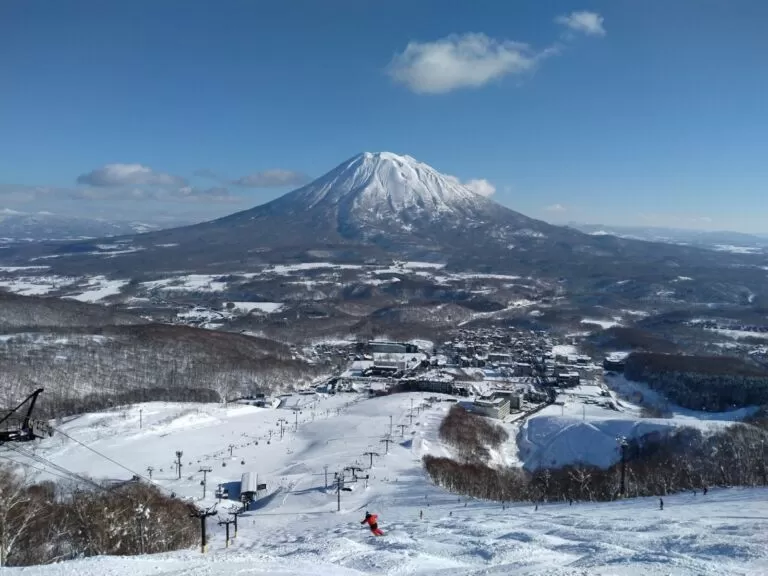
| Day 5 | To Kutchan at the foot of Mt. Yotei: a short drive and a rest day | 25.4km | 27 min |
| Day 6 | Past Lake Toya to Imakane in southern Hokkaido | 124km | 1 h 55 min |
| Day 7 | Via Esashi on the Sea of Japan side to Kikonai | 158km | 2 h 37 min |
| Day 8 | To Hakodate, with Mt. Hakodate at night | 43.9km | 41 min |
| Day 9 | Morning market and a stroll in Hakodate (no driving) | — | — |
| Day 10 | Past Onuma to Muroran | 196km | 2 h 42 min |
| Day 11 | See Upopoy in Shiraoi, then on to Atsuma | 114km | 1 h 33 min |
| Day 12 | Along the Hidaka coast to Erimo | 158km | 2 h 45 min |
| Day 13 | From Cape Erimo to Kita no Mori in Taiki | 94.4km | 1 h 39 min |
| Day 14 | Rest day at Kita no Mori (no driving) | — | — |
| Day 15 | Through Obihiro to Ikeda | 87km | 1 h 47 min |
| Day 16 | Past Lake Akan to Akan | 140km | 2 h 13 min |
| Day 17 | See the Kushiro Wetland and go on to Nemuro | 162km | 2 h 41 min |
| Day 18 | Past the Notsuke Peninsula to Rausu | 155km | 2 h 27 min |
| Day 19 | Over Shiretoko Pass to the Shiretoko Five Lakes, then Bihoro | 151km | 2 h 46 min |
| Day 20 | Round trip to Lake Mashu (second night in Bihoro) | 121km | 1 h 59 min |
| Day 21 | To Abashiri, with a break at the Drift Ice Museum | 35.8km | 44 min |
| Day 22 | Past the Lake Saroma observatory to Engaru | 113km | 2 h 6 min |
| Day 23 | To Nayoro: an RV park with a hot spring | 169km | 2 h 29 min |
| Day 24 | To Wakkanai, Japan’s northernmost city | 161km | 2 h 26 min |
| Day 25 | Round trip to Cape Soya (second night in Wakkanai) | 51.2km | 54 min |
| Day 26 | South along the Ororon Line: Sarobetsu Wetland and Tomamae | 144km | 2 h 24 min |
| Day 27 | Past Rumoi to Asahikawa | 140km | 2 h 16 min |
| Day 28 | See the hills of Biei, with 2 nights in Biei | 37.3km | 49 min |
| Day 29 | Blue Pond and Farm Tomita (second night in Biei) | 59.4km | 1 h 15 min |
| Day 30 | Back to New Chitose Airport to return the vehicle | 159km | 2 h 31 min |
Week 1 | Central and Southern Hokkaido (Days 1–9): Sapporo, Shakotan, Lake Toya, Hakodate
Day 1 — Pick up the vehicle at New Chitose Airport and head to Koganeyu, south of Sapporo
Day 1 is for picking up the vehicle at the airport and getting your luggage in order. You stay 2 nights at an RV park in Koganeyu, in Minami Ward, Sapporo, just before Jozankei.
▼Today’s route: New Chitose Airport → Sapporo (outdoor base TRIOUT) About 1 h 12 min by car, 65.2 km (Google Maps estimate, no breaks).Open directions in Google Maps
| Address | 644-52 Koganeyu, Minami-ku, Sapporo, Hokkaido 061-2274 |
|---|---|
| Phone | 080-1889-4237 |
| Price | Campervan (with power) ¥1,500 per night. Only 2 sites have power, at ¥400 per day |
| Power | Yes (extra charge) |
| Bath | None (use the day-use bath at the nearby Koganeyu Onsen) |
| Dump station (wastewater disposal) | Available (extra charge) |
| Pets | Allowed |
| Check-in | 13:00–20:00 |
| Booking | Phone / Web |
| Details page | hokkaido-campingcar.jp |
Day 2 — Shopping and a stroll around Sapporo (no driving)
This is a day to leave the vehicle parked and take the subway or bus into Sapporo. Pick up daily necessities and warm clothes you will need for a 30-day trip.
Day 3 — Past Otaru Canal and Yoichi to Akaigawa
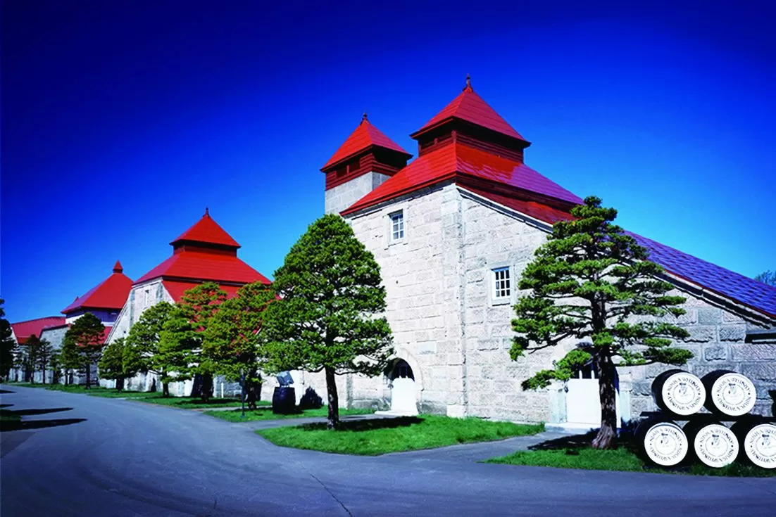
Walk along Otaru Canal in the morning, tour the whisky distillery in Yoichi, then head to the RV park in Akaigawa Village.
| Tourist information center | Otaru Canal Tourist Information Center (5-4 Minatomachi, Otaru). 9:00–18:00, open every day |
|---|---|
| Parking | Otaru International Information Center (5-3 Minatomachi), 91 spaces. ¥300 per hour, maximum ¥1,000 per day |
| Official site | www.city.otaru.lg.jp |
| Opening hours | 9:00–17:00, closed over the New Year holidays |
|---|---|
| Price | Free (guided tours by reservation) |
| Official site | yoichi-kankoukyoukai.com |
▼Today’s route: Sapporo (outdoor base TRIOUT) → Otaru Canal → Nikka Whisky Yoichi Distillery → Akaigawa (AKAIGAWA TOMO PLAYPARK) About 1 h 52 min by car, 89 km (Google Maps estimate, no breaks).Open directions in Google Maps
| Address | 56 Meiji, Akaigawa Village, Yoichi District, Hokkaido 046-0552 |
|---|---|
| Phone | 0135-34-7575 |
| Price | ¥3,800 per night (includes up to 2 adults) |
| Power | Yes (free) |
| Bath | None |
| Check-in | 11:30–18:00 |
Day 4 — Round trip to the Shakotan Peninsula: Shimamui Coast and Cape Kamui
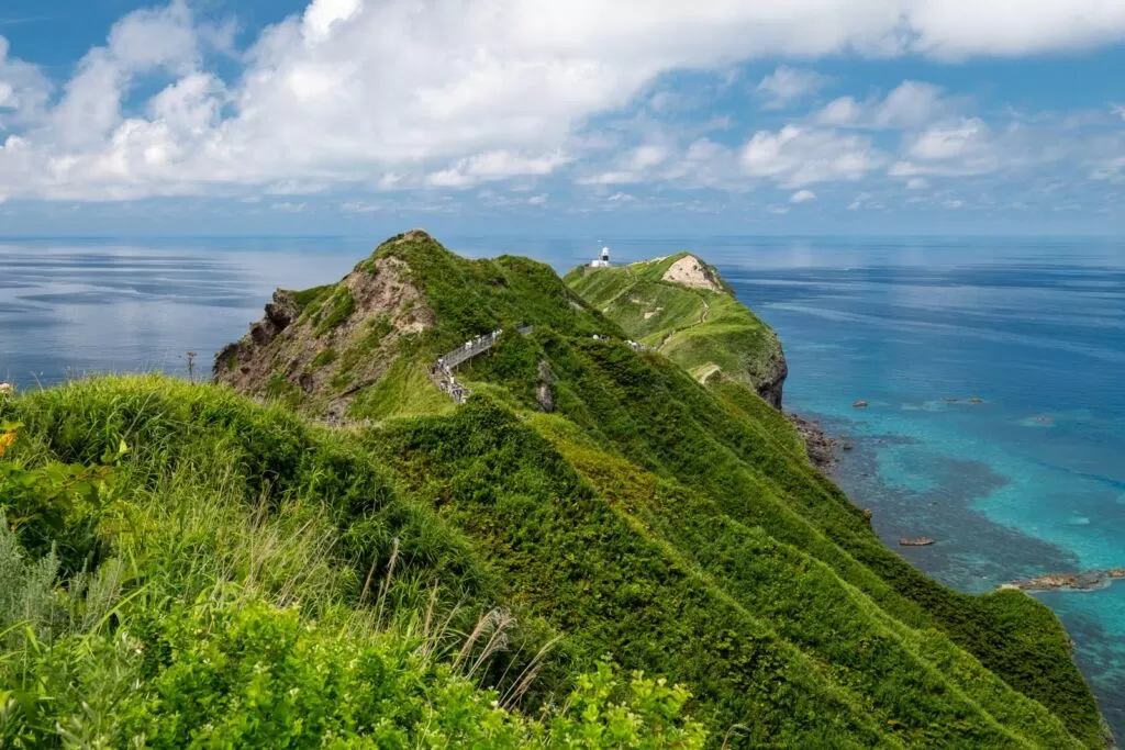
Leave your luggage in Akaigawa and make a round trip to the tip of the Shakotan Peninsula. Look down on the cove from the Shimamui Coast viewpoint, then walk the ridge path at Cape Kamui.
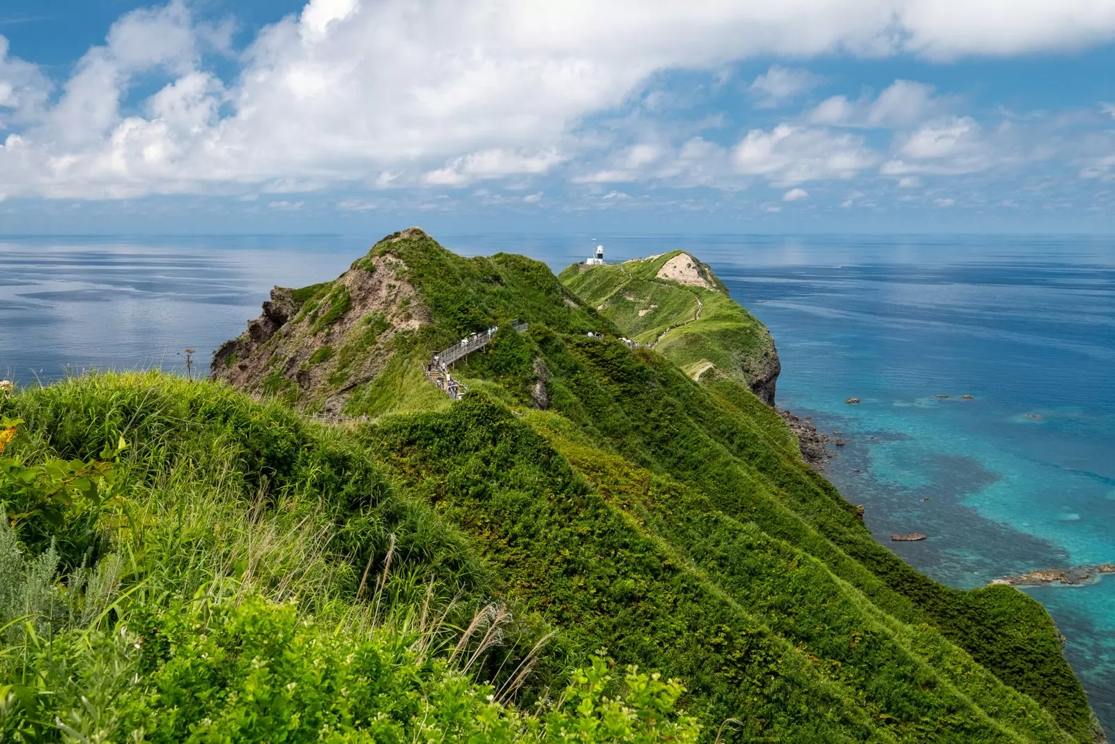
| Entrance gate hours | July 8:00–18:00; August–October 8:00–17:30 (last entry 1 hour before closing) |
|---|---|
| Walking trail | The trail to the tip is closed from October 5, 2026 to early April 2027 (planned). For the year you travel, check with the Shakotan Tourism Association |
| Official site | www.kanko-shakotan.jp |
▼Today’s route: Round trip from Akaigawa (AKAIGAWA TOMO PLAYPARK) to Shimamui Coast and Cape Kamui About 3 h 2 min by car, 150 km (Google Maps estimate, no breaks). The round trip is 3 hours of driving, so set out early in the morning.Open directions in Google Maps
Day 5 — To Kutchan at the foot of Mt. Yotei: a short drive and a rest day
It is only about 30 minutes from Akaigawa to Kutchan. Spend the day at the foot of Mt. Yotei, using it for laundry and tidying the vehicle.
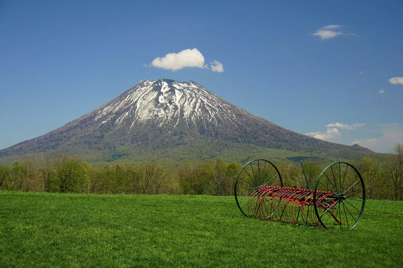
▼Today’s route: Akaigawa (AKAIGAWA TOMO PLAYPARK) → RV Park Kutchan About 27 min by car, 25.4 km (Google Maps estimate, no breaks).Open directions in Google Maps
| Address | 117-4 Takasago, Kutchan, Abuta District, Hokkaido 044-0076 |
|---|---|
| Phone | 0136-55-7731 |
| Price | General: ¥2,970 per night per vehicle |
| Power | Yes (extra charge) |
| Bath | None |
| Dump station (wastewater disposal) | Available (extra charge) |
| Pets | Allowed |
| Check-in | 13:00–18:00 |
| Booking | Phone / Web |
| Official site | rvpark-kutchan.com |
Day 6 — Past Lake Toya to Imakane in southern Hokkaido
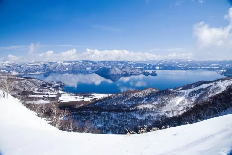
Stop at Toyako Onsen to see the lake, then drive southwest to RV Park Pirika in Imakane. Pirika has a hot spring.
| Address | 142 Toyako Onsen, Toyako, Abuta District, Hokkaido 049-5721 |
|---|---|
| Phone | 0142-75-2446 |
| Opening hours | 9:00–17:00 |
| Official site | www.laketoya.com |
▼Today’s route: RV Park Kutchan → Toyako Onsen → Imakane (RV Park Pirika) About 1 h 55 min by car, 124 km (Google Maps estimate, no breaks).Open directions in Google Maps
| Address | 205-1 Pirika, Imakane, Setana District, Hokkaido 049-4151 |
|---|---|
| Phone | 0137-83-7111 |
| Price | Parking area: without power ¥2,000–¥2,500; with power ¥2,500–¥3,000 |
| Power | Yes |
| Bath | Yes (hot spring) |
| Dump station (wastewater disposal) | Available (extra charge) |
| Pets | Allowed |
| Check-in | 14:00–18:30 |
| Booking | Phone |
| Details page | hokkaido-campingcar.jp |
Day 7 — Via Esashi on the Sea of Japan side to Kikonai
From Imakane you come out on the Sea of Japan side, pass through the town of Esashi, and continue to Kikonai.
▼Today’s route: Imakane (RV Park Pirika) → Esashi → Kikonai (Misogi no Oka RV Park) About 2 h 37 min by car, 158 km (Google Maps estimate, no breaks).Open directions in Google Maps
| Address | 60-7 Taihei, Kikonai, Kamiiso District, Hokkaido 049-0412 |
|---|---|
| Phone | 090-1646-7859 |
| Price | General: ¥2,970 per night |
| Power | Yes (extra charge) |
| Bath | None |
| Dump station (wastewater disposal) | Allowed (free) |
| Pets | Allowed |
| Check-in | 13:00–16:00 |
| Booking | Web only |
| Official site | kikonainotoya.com |
Day 8 — To Hakodate, with Mt. Hakodate at night
Hakodate is about 40 minutes from Kikonai. In the evening, go up Mt. Hakodate for the night view. In summer, private cars are restricted from evening into the night, so take the ropeway up.
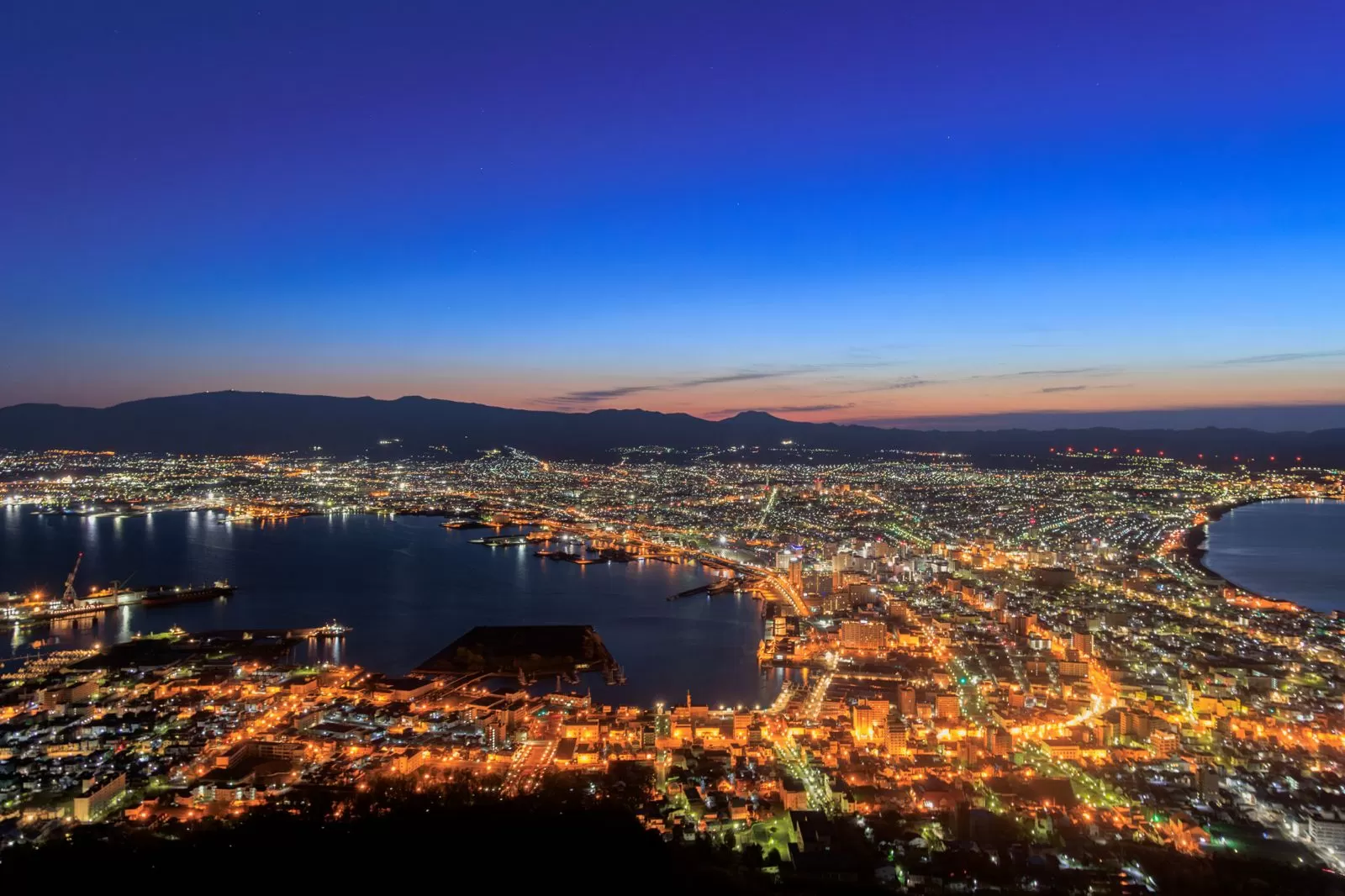
| Hours | April 20–September 30: 10:00–22:00 (last ascent 21:30) |
|---|---|
| Price | Round trip: adults ¥1,800, children ¥900 |
| Driving to the summit | In summer (April 17–September 30), private cars are restricted from 17:00 to 22:00 |
| Official site | 334.co.jp |
▼Today’s route: Kikonai (Misogi no Oka RV Park) → Hakodate (RV Park Hakodate Ryokuen-dori) About 41 min by car, 43.9 km (Google Maps estimate, no breaks).Open directions in Google Maps
| Address | 3-15-11 Hondori, Hakodate, Hokkaido 041-0851 |
|---|---|
| Phone | 0138-35-7000 |
| Price | General: ¥2,000 per night (¥2,500 for vehicles 6 m or longer) |
| Power | Yes (extra charge) |
| Bath | None |
| Dump station (wastewater disposal) | Available (extra charge) |
| Pets | Allowed |
| Check-in | 14:00–18:00 |
| Booking | Phone / Web |
| Official site | www.hotelryokuendori.com |
Day 9 — Morning market and a stroll in Hakodate (no driving)
Have breakfast at the Hakodate Morning Market. At midday, walk the slopes of Motomachi and the harbor. The vehicle stays put.
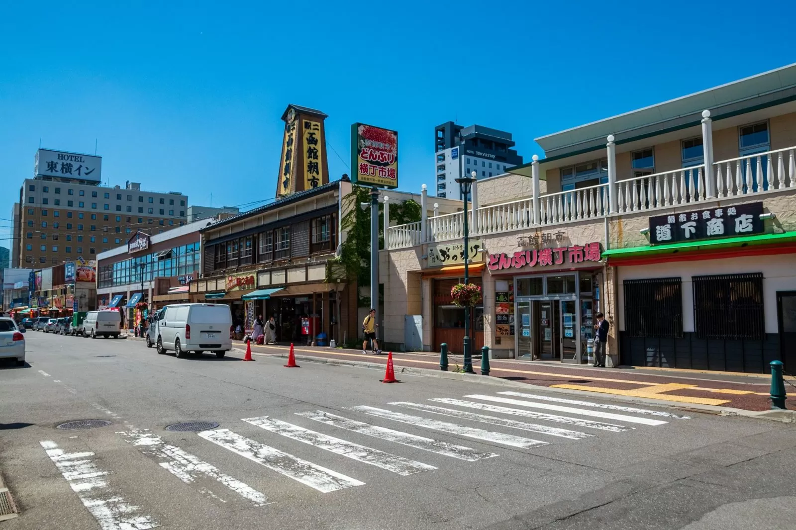
| Hours | May–December: 5:00 to a little after 14:00 (varies by shop) |
|---|---|
| Parking | About 350 spaces (including the surrounding area). Normally ¥100 per 20 minutes. Spend ¥2,200 or more at member shops for 60 minutes free |
| Official site | www.hakodate-asaichi.com |
Week 2 | From Muroran to Hidaka and Tokachi (Days 10–15): Upopoy, Cape Erimo, Kita no Mori
Day 10 — Past Onuma to Muroran
See Mt. Komagatake and the lake at Onuma, then drive along Uchiura Bay to Muroran. This is the longest day of the trip, so set out in the morning.
| Address | 85-15 Onumacho, Nanae, Kameda District, Hokkaido (next to JR Onuma-Koen Station) |
|---|---|
| Phone | 0138-67-2170 |
| Opening hours | 9:00–17:00, closed over the New Year holidays |
| Parking | The plaza’s parking lot has 15 spaces |
| Official site | guruttoonuma.net |
▼Today’s route: Hakodate (RV Park Hakodate Ryokuen-dori) → Onuma Quasi-National Park → Muroran (ZEKKEI BASE CAMP) About 2 h 42 min by car, 196 km (Google Maps estimate, no breaks).Open directions in Google Maps
| Address | 4-2-23 Etomo-cho, Muroran, Hokkaido 051-0035 |
|---|---|
| Phone | 090-8905-7271 |
| Price | Water and trash disposal ¥2,750; with power ¥3,300 |
| Power | Yes (extra charge) |
| Bath | None |
| Dump station (wastewater disposal) | Allowed (free) |
| Pets | Allowed |
| Check-in | 14:00– |
| Booking | Web only |
| Details page | hokkaido-campingcar.jp |
Day 11 — See Upopoy in Shiraoi, then on to Atsuma
At Upopoy (National Ainu Museum and Park) in Shiraoi, see the Ainu culture exhibits and performances. In some summer weeks it is closed on Mondays, so check the schedule before you go.
| Address | 2-3 Wakakusa-cho, Shiraoi, Shiraoi District, Hokkaido 059-0902 |
|---|---|
| Phone | 0144-82-3914 |
| Summer hours | 9:00–18:00 (last entry 1 hour before closing, fiscal 2026) |
| Closed | Mondays (in 2026, also open on Mondays July 27, August 10 and August 24) |
| Admission | Adults ¥1,200, high school students ¥600, junior high school students and younger free |
| Parking | Parking Lot 1: 246 spaces, ¥500 per entry. Vehicles over 2 m high, 5 m long, 1.9 m wide or 2 t in weight go to the large-bus parking lot (¥2,000) |
| Official site | ainu-upopoy.go.jp |
▼Today’s route: Muroran (ZEKKEI BASE CAMP) → Upopoy → Atsuma (RV FOREST 310) About 1 h 33 min by car, 114 km (Google Maps estimate, no breaks).Open directions in Google Maps
| Address | 481-36 Toyosawa, Atsuma, Yufutsu District, Hokkaido 059-1624 |
|---|---|
| Phone | 0145-29-7002 |
| Price | General: ¥4,000 per night |
| Power | Yes (free) |
| Bath | None |
| Check-in | 13:00–19:00 |
Day 12 — Along the Hidaka coast to Erimo
From Atsuma, pass through Niikappu and drive south along the Hidaka coast. You stay at Hyakuninhama Auto Campsite.
▼Today’s route: Atsuma (RV FOREST 310) → Niikappu → Erimo (Hyakuninhama Auto Campsite) About 2 h 45 min by car, 158 km (Google Maps estimate, no breaks).Open directions in Google Maps
| Address | Erimo |
|---|---|
| Open season | Year-round (irregular closures from November) |
| Price | Auto sites from ¥2,500 for small vehicles (varies by season and day of the week) |
| Power | 19 auto sites (with AC power) |
| Bath | 2 shower rooms in the management center, and a day-use bath next door (closed Mondays) |
| Pets | Conditional |
| Details page | hokkaido-campingcar.jp |
Day 13 — From Cape Erimo to Kita no Mori in Taiki
Stop at Cape Erimo in the morning and look out toward the tip of the cape from the Kaze no Yakata (Wind Museum). Then head north to Taiki in Tokachi and stay 2 nights at Kita no Mori.
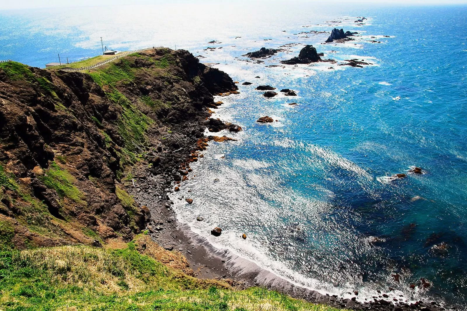
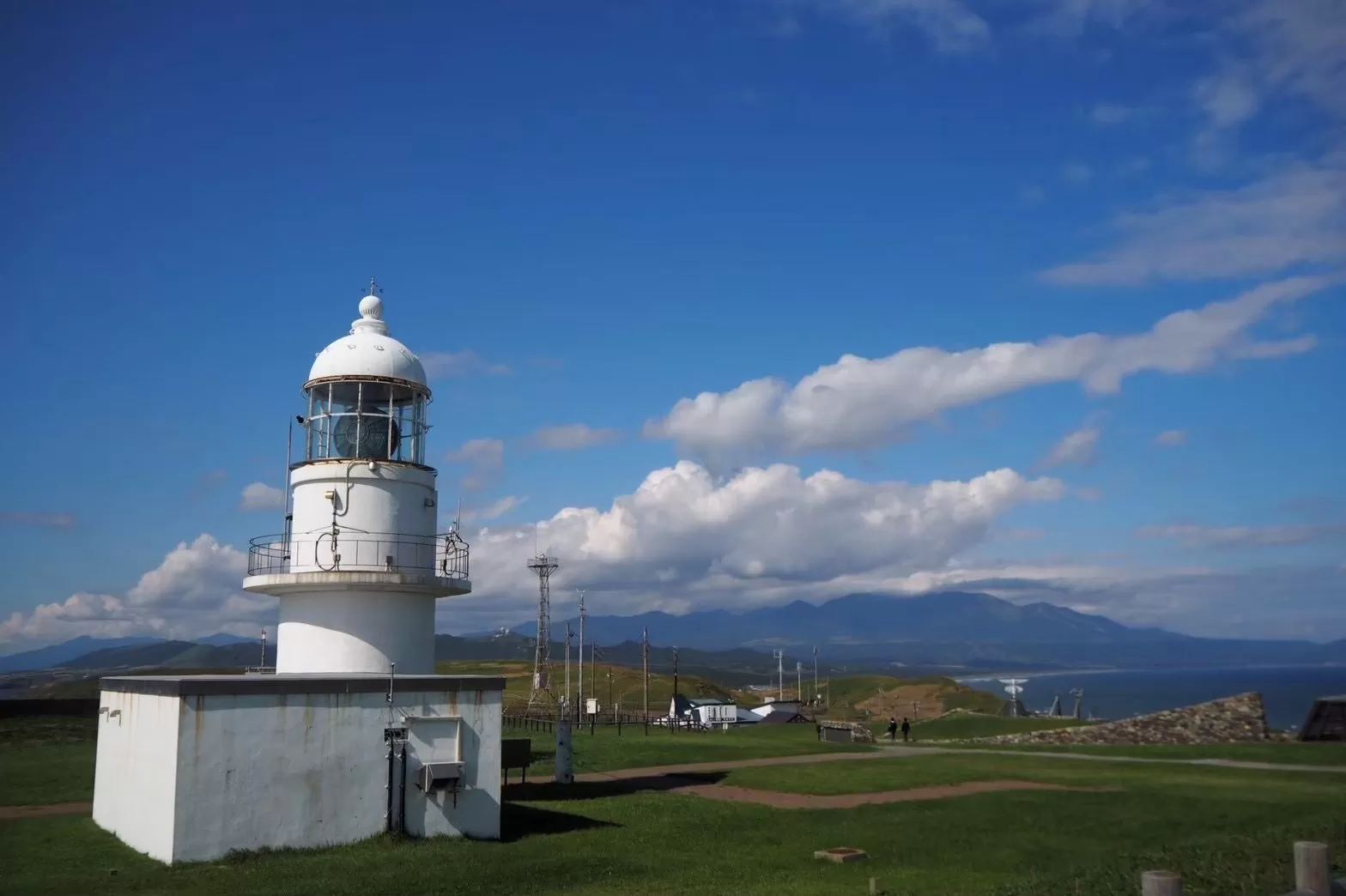
| Address | 366-3 Toyo, Erimo, Horoizumi District, Hokkaido 058-0343 |
|---|---|
| Phone | 01466-3-1133 |
| Hours, May–August | 9:00–18:00 (last entry 17:30), open every day during this period |
| Admission | Adults ¥300, elementary to high school students ¥200 |
| Official site | www.town.erimo.lg.jp |
▼Today’s route: Erimo (Hyakuninhama Auto Campsite) → Cape Erimo → Taiki (Kita no Mori) About 1 h 39 min by car, 94.4 km (Google Maps estimate, no breaks).Open directions in Google Maps
| Address | 44-5 Kochien, Taiki, Hiroo District, Hokkaido 089-2271 |
|---|---|
| Phone | 0155-88-7514 |
| Price | From ¥12,599 per person (6 per unit, early-bird; Moving Inn booking page, checked 2026-10-28) |
| Power | Yes (free) |
| Bath | Shower room and open-air bath for each site |
| Dump station (wastewater disposal) | Allowed (free) |
| Pets | Allowed |
| Check-in | 15:00– |
| Booking | Phone / Web |
| Details page | hokkaido-campingcar.jp |
Day 14 — Rest day at Kita no Mori (no driving)
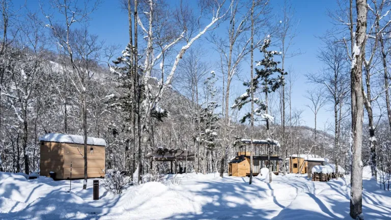
At the halfway point of the trip, this is a day to rest without moving the vehicle. Kita no Mori is an RV park with only 4 sites, and each site has its own shower room, open-air bath and toilet (Kita no Mori details page).
Day 15 — Through Obihiro to Ikeda
Shop for supplies in the city of Obihiro, then head to Tokachi Makiba no Ie in the town of Ikeda.
▼Today’s route: Taiki (Kita no Mori) → Obihiro Station → Ikeda (Tokachi Makiba no Ie) About 1 h 47 min by car, 87 km (Google Maps estimate, no breaks).Open directions in Google Maps
| Address | 144 Kiyomi, Ikeda, Nakagawa District, Hokkaido 083-0002 |
|---|---|
| Phone | 015-572-6000 |
| Price | ¥3,000–¥3,600 per vehicle + ¥800–¥960 per adult |
| Power | Yes (free) |
| Bath | None |
| Check-in | 14:00–18:00 |
Week 3 | Eastern Hokkaido and Shiretoko (Days 16–23): Akan, Nemuro, Shiretoko, Lake Mashu, Abashiri
Day 16 — Past Lake Akan to Akan
Stop at Akanko Onsen and walk along the lakeshore, then continue to Akan Tancho no Sato. The price includes one person’s hot spring entry.
▼Today’s route: Ikeda (Tokachi Makiba no Ie) → Akanko Onsen → Akan (Akan Tancho no Sato) About 2 h 13 min by car, 140 km (Google Maps estimate, no breaks).Open directions in Google Maps
| Address | 23-36-1 Kamiakan, Akan-cho, Kushiro, Hokkaido 085-0245 |
|---|---|
| Phone | 0154-66-2330 |
| Price | ¥1,500 per vehicle (includes trash disposal and one person’s hot spring entry). Power is +¥500 |
| Power | Yes (extra charge) |
| Bath | Yes (hot spring) |
| Dump station (wastewater disposal) | Allowed (free) |
| Pets | Allowed |
| Check-in | 13:00–21:00 (front desk with the red beret) |
| Booking | Phone |
| Official site | www.akan.jp |
Day 17 — See the Kushiro Wetland and go on to Nemuro
Look out over the wetland from the Kushiro City Marsh Observatory, then drive east to Nemuro.
▼Today’s route: Akan (Akan Tancho no Sato) → Kushiro City Marsh Observatory → Nemuro (RV Park Midori) About 2 h 41 min by car, 162 km (Google Maps estimate, no breaks).Open directions in Google Maps
| Address | 1-23 Midori-cho, Nemuro, Hokkaido 087-0051 |
|---|---|
| Phone | 090-2691-3797 |
| Price | Without power ¥3,500; with power ¥4,000 |
| Power | Yes |
| Bath | None |
| Dump station (wastewater disposal) | Allowed (free) |
| Pets | Allowed |
| Check-in | 13:00–17:00 |
| Booking | Phone |
| Details page | hokkaido-campingcar.jp |
Day 18 — Past the Notsuke Peninsula to Rausu
Stop at the Notsuke Peninsula, which juts out thinly into the sea, then head to Rausu on the east side of the Shiretoko Peninsula.
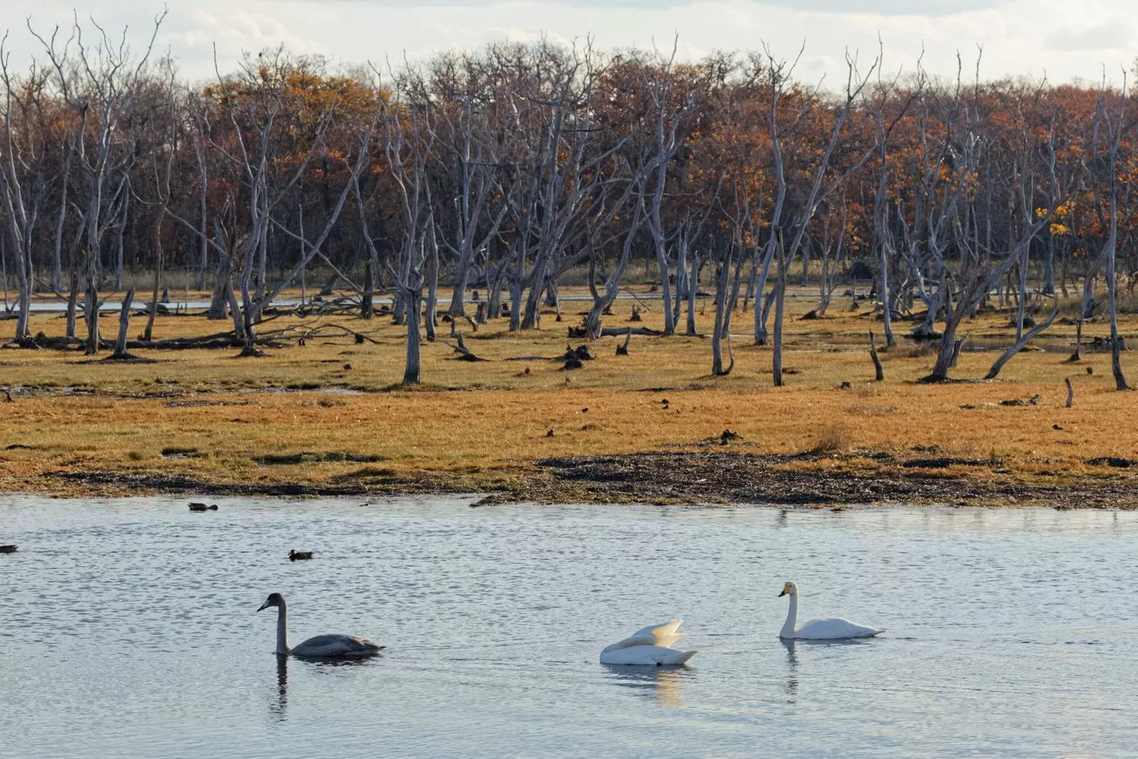
| Address | 63 Notsuke, Betsukai, Notsuke District, Hokkaido 086-1645 |
|---|---|
| Opening hours | April–September 9:00–17:00 |
| Price | Free admission |
| Parking | 50 cars and 10 buses |
| Official site | www.notsuke.jp |
▼Today’s route: Nemuro (RV Park Midori) → Notsuke Peninsula Nature Center → Rausu Auto Campsite About 2 h 27 min by car, 155 km (Google Maps estimate, no breaks).Open directions in Google Maps
| Address | Horomoe-cho, Rausu, Menashi District |
|---|---|
| Open season | In 2026: May 22 to October 4 |
| Price | Campervan auto sites: without power ¥1,500; with power ¥2,000 (per day) |
| Power | Sites with power available |
| Details page | hokkaido-campingcar.jp |
Day 19 — Over Shiretoko Pass to the Shiretoko Five Lakes, then Bihoro
Cross Shiretoko Pass on the Shiretoko Crossing Road and go to the Shiretoko Five Lakes on the Utoro side. You can walk the elevated boardwalk without any procedure. Then descend to Toge no Yu Bihoro in Bihoro.
| Section | Rausu-cho Yunosawa to Shari-cho Iwaobetsu (about 23.8 km) |
|---|---|
| 2026 opening | Open all day from 8:00 on May 29 (Abashiri Development and Construction Department). It may close because of weather |
| Inquiries | Abashiri Road Office 0152-43-4328 |
| Official site | www.hkd.mlit.go.jp |
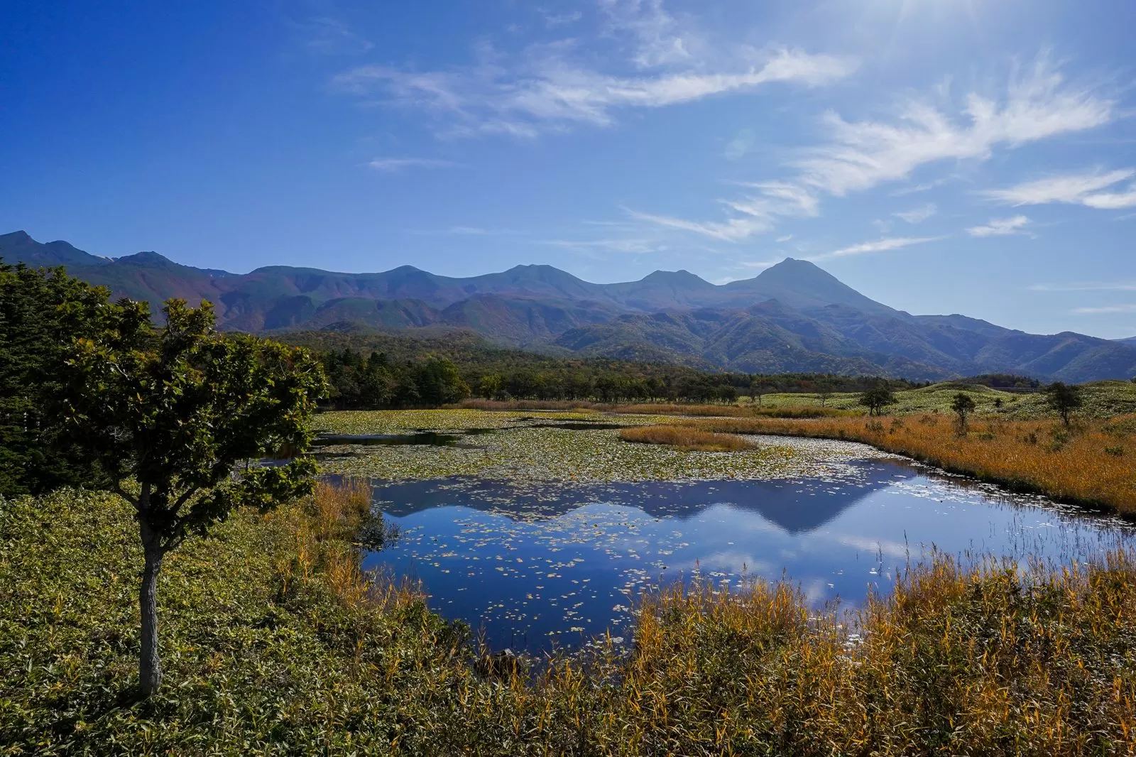
| Elevated boardwalk | Free from opening to closing; no procedure required |
|---|---|
| Ground trail | May 10–July 31: you must join a guided tour. August 1 to closing: a lecture (adults ¥450) |
| Summer park hours | April 21–August 31: 8:00–18:30 (2026) |
| Parking | About 100 spaces, paid |
| Official site | www.goko.go.jp |
▼Today’s route: Rausu Auto Campsite → Shiretoko Pass → Shiretoko Five Lakes → Bihoro (Toge no Yu Bihoro) About 2 h 46 min by car, 151 km (Google Maps estimate, no breaks).Open directions in Google Maps
| Address | 40-1 Azamiyakobashi, Bihoro, Abashiri District, Hokkaido 092-0026 |
|---|---|
| Phone | 0152-73-2121 |
| Price | General: ¥3,000 per night per vehicle (up to 5 vehicles) |
| Power | Yes (extra charge) |
| Bath | Yes (hot spring) |
| Check-in | 15:00–21:00 |
Day 20 — Round trip to Lake Mashu (second night in Bihoro)
Leave your luggage in Bihoro and make a round trip to the Lake Mashu No. 1 Observatory.
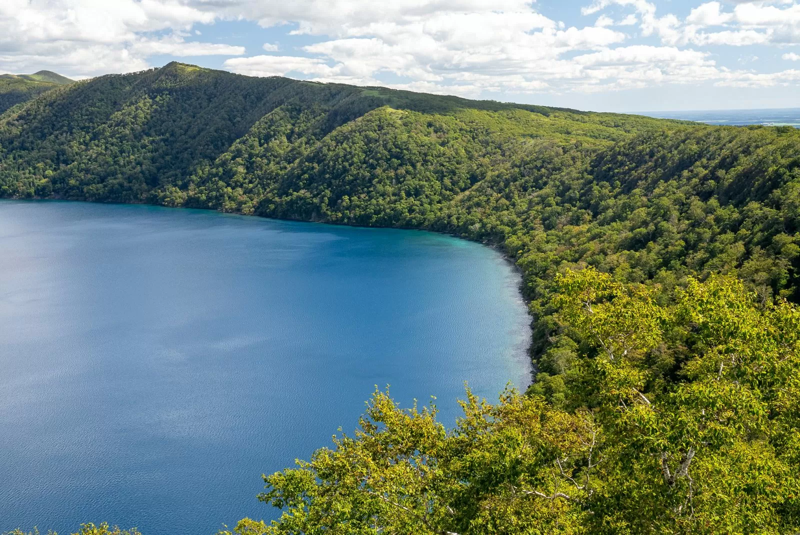
| Inquiries | Mashuko Kamui Terrace 015-482-1530 (8:30–17:00, open every day) |
|---|---|
| Parking fee | May 1–October 31: ¥500 for a passenger car (valid for the day) |
| Official site | mashuko-iozan.jp |
▼Today’s route: Round trip from Bihoro (Toge no Yu Bihoro) to the Lake Mashu No. 1 Observatory About 1 h 59 min by car, 121 km (Google Maps estimate, no breaks).Open directions in Google Maps
Day 21 — To Abashiri, with a break at the Drift Ice Museum
It is about 40 minutes from Bihoro to Abashiri. At the Okhotsk Drift Ice Museum on Mt. Tento, see the room where you can touch real drift ice.

| Address | 244-3 Tentozan, Abashiri, Hokkaido 093-0044 |
|---|---|
| Opening hours | May–October 8:30–18:00 (last entry 17:30) |
| Price | Adults ¥990, high school students ¥880, elementary and junior high school students ¥770 |
| Parking | 150 passenger cars |
| Official site | www.ryuhyokan.com |
▼Today’s route: Bihoro (Toge no Yu Bihoro) → Okhotsk Drift Ice Museum → Abashiri (ABASHIRI BAY) About 44 min by car, 35.8 km (Google Maps estimate, no breaks).Open directions in Google Maps
| Address | 5-8 Motokoto, Abashiri, Hokkaido 099-3111 |
|---|---|
| Phone | 090-4873-3670 |
| Price | ¥1,500 per night (power is extra) |
| Power | Yes (extra charge) |
| Bath | None |
| Dump station (wastewater disposal) | Available (extra charge) |
| Pets | Allowed |
| Check-in | 13:00–21:00 |
| Booking | Web only |
Day 22 — Past the Lake Saroma observatory to Engaru
Stop at the observatory overlooking Lake Saroma, then head inland to Engaru. The road to the observatory is one-way.
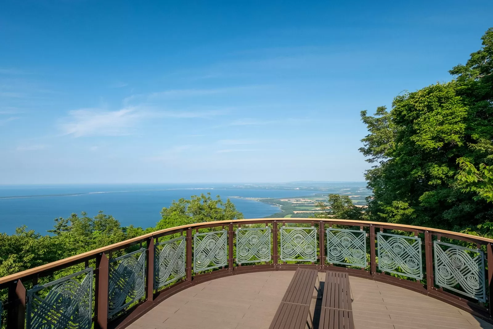
| Inquiries | Saroma Town, Economic Affairs Division, Commerce, Industry and Tourism Section 01587-2-1200 |
|---|---|
| Road for vehicles | The road to the observatory is one-way. Enter from the east entrance on National Route 238 |
| Brown bears | On September 26, 2026, a bear appeared and the hiking trail was closed to climbing. It was reopened on October 15 (visitors are advised to carry bear bells and the like). You can drive up to the observatory |
| Official site | www.town.saroma.hokkaido.jp |
▼Today’s route: Abashiri (ABASHIRI BAY) → Lake Saroma Observatory → Engaru (Engaru-machi Hotel Sunshine) About 2 h 6 min by car, 113 km (Google Maps estimate, no breaks).Open directions in Google Maps
| Address | 1-1-1 Odori-kita, Engaru, Monbetsu District, Hokkaido 099-0404 |
|---|---|
| Phone | 0158-42-1151 |
| Price | General: ¥3,300 per night per vehicle |
| Power | Yes (free) |
| Bath | None |
| Dump station (wastewater disposal) | Allowed (free) |
| Pets | Allowed |
| Check-in | 15:00–21:00 |
| Booking | Phone |
| Official site | hotel-sunshine.jp |
Day 23 — To Nayoro: an RV park with a hot spring
From Engaru, head northwest to Nayoro. Nayoro Onsen Sun Pillar is an RV park with a hot spring.
▼Today’s route: Engaru (Engaru-machi Hotel Sunshine) → Nayoro (Nayoro Onsen Sun Pillar) About 2 h 29 min by car, 169 km (Google Maps estimate, no breaks).Open directions in Google Maps
| Address | Nisshin, Nayoro, Hokkaido 096-0066 |
|---|---|
| Phone | 01654-2-2131 |
| Price | ¥2,500 per night per vehicle |
| Power | Yes (free) |
| Bath | Yes (hot spring) |
| Dump station (wastewater disposal) | Available (extra charge) |
| Pets | Allowed |
| Check-in | 12:00–20:00 |
| Booking | Phone |
| Details page | hokkaido-campingcar.jp |
Week 4 | Soya, the Ororon Line and Biei (Days 24–30)
Day 24 — To Wakkanai, Japan’s northernmost city
Drive north from Nayoro on National Route 40 and stay 2 nights at Soya Fureai Park Auto Campsite in Wakkanai.
▼Today’s route: Nayoro (Nayoro Onsen Sun Pillar) → Wakkanai (Soya Fureai Park Auto Campsite) About 2 h 26 min by car, 161 km (Google Maps estimate, no breaks).Open directions in Google Maps
| Address | 5-40-1 Koetoi, Wakkanai, Hokkaido |
|---|---|
| Open season | In fiscal 2026, until September 30 |
| Price | Campervan sites: normally ¥3,000 + admission fee |
| Power | Sites with electricity and water available |
| Pets | Allowed at the 4 campervan sites and others |
| Details page | hokkaido-campingcar.jp |
Day 25 — Round trip to Cape Soya (second night in Wakkanai)
Make a round trip to Cape Soya, where the monument marking Japan’s northernmost point stands. It is a short driving day.
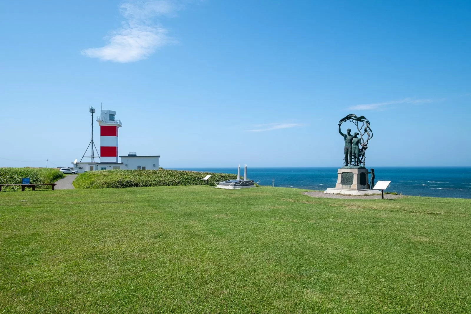
▼Today’s route: Round trip from Wakkanai (Soya Fureai Park Auto Campsite) to Cape Soya About 54 min by car, 51.2 km (Google Maps estimate, no breaks).Open directions in Google Maps
Day 26 — South along the Ororon Line: Sarobetsu Wetland and Tomamae
Drive south along the Ororon Line on the Sea of Japan coast. Walk the boardwalk at the Sarobetsu Wetland Center, pass Otonruru, where 28 wind turbines line the coast, and continue to Tomamae. Tomamae Yuhigaoka Auto Campsite is booked through the town of Tomamae’s official LINE account. Pets are not allowed.
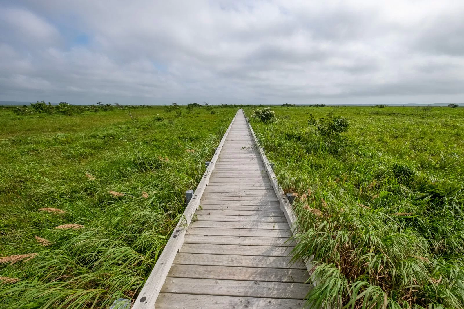
| Opening hours | May–October 9:00–17:00 (boardwalk open 24 hours), open every day May–October |
|---|---|
| Parking | Yes |
| Official site | sarobetsu.or.jp |
▼Today’s route: Wakkanai (Soya Fureai Park Auto Campsite) → Sarobetsu Wetland Center → Otonruru Wind Farm → Tomamae (Tomamae Yuhigaoka Auto Campsite) About 2 h 24 min by car, 144 km (Google Maps estimate, no breaks).Open directions in Google Maps
| Address | 67-1 Sakaehama, Tomamae, Tomamae-cho |
|---|---|
| Open season | In 2026: April 25 to September 30 |
| Price | Auto site A ¥4,250 (20A power); B ¥2,050 |
| Power | 20A power at A sites |
| Bath | Showers and coin laundry at the center house |
| Pets | Not allowed |
| Official site | www.town.tomamae.lg.jp |
Day 27 — Past Rumoi to Asahikawa
From Rumoi, go inland to Johnny Base in Asahikawa.
▼Today’s route: Tomamae (Tomamae Yuhigaoka Auto Campsite) → Rumoi → Asahikawa (Johnny Base) About 2 h 16 min by car, 140 km (Google Maps estimate, no breaks).Open directions in Google Maps
| Address | 282 Shimohyoson, Higashiasahikawa-cho, Asahikawa, Hokkaido 078-8208 |
|---|---|
| Phone | 090-2074-9287 |
| Price | Standard site (with 20A power): ¥3,000 per night |
| Power | Yes (free) |
| Bath | None |
| Check-in | 15:00–19:00 |
Day 28 — See the hills of Biei, with 2 nights in Biei
Look out over the patchwork hills from Hokusei no Oka Observation Park, then stay 2 nights at Aizome Yui no Mori in Biei.
| Address | Okubo Kyosei, Biei, Kamikawa District, Hokkaido |
|---|---|
| Inquiries | 0166-92-4378 (Biei Tourism Association) |
| Price | Free |
| Parking | 30 cars and 5 buses; a second lot below the observatory (10 cars). Free. It can be full on busy days |
| Winter | The observatory is closed during the snow season because it is slippery. No toilet in winter |
| Official site | www.biei-hokkaido.jp |
▼Today’s route: Asahikawa (Johnny Base) → Hokusei no Oka Observation Park → Biei (Aizome Yui no Mori) About 49 min by car, 37.3 km (Google Maps estimate, no breaks).Open directions in Google Maps
| Address | Takushin, Biei, Kamikawa District, Hokkaido 071-0474 |
|---|---|
| Phone | 0166-74-8855 |
| Price | General: ¥4,000 per night per vehicle (¥6,000 for towed trailers) |
| Power | Yes (free) |
| Bath | None |
| Check-in | 12:00–20:00 |
Day 29 — Blue Pond and Farm Tomita (second night in Biei)
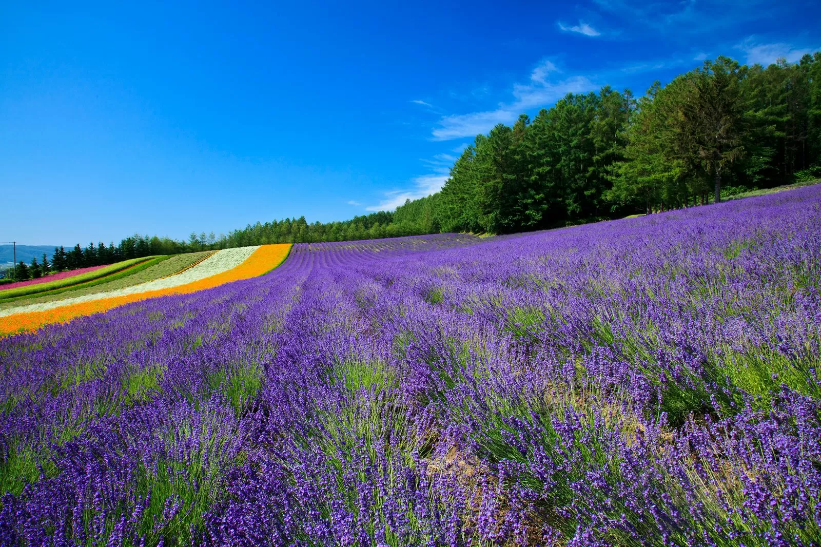
Visit Shirogane Blue Pond and Farm Tomita, known for its lavender. Overnight parking is prohibited in Farm Tomita’s parking lot.
| Inquiries | 0166-92-4378 (Biei Tourism Association) |
|---|---|
| Parking fee | Passenger cars ¥1,000. Vehicles 6 m or longer in total length are treated as large vehicles at ¥6,000, with a separate entrance (from July 1, 2026) |
| Official site | www.biei-hokkaido.jp |
| Price | Admission and parking are both free |
|---|---|
| Hours in late June to mid-August | 8:30–17:30 |
| Parking | Overnight parking is prohibited. Campervans are directed to use nearby town-run parking lots and the like. |
| Official site | www.farm-tomita.co.jp |
▼Today’s route: Round trip from Biei (Aizome Yui no Mori) to Shirogane Blue Pond and Farm Tomita About 1 h 15 min by car, 59.4 km (Google Maps estimate, no breaks).Open directions in Google Maps
Day 30 — Back to New Chitose Airport to return the vehicle
It is 2 h 31 min from Biei to New Chitose Airport. Check the return time and the refueling and washing rules with the rental company.
▼Today’s route: Biei (Aizome Yui no Mori) → New Chitose Airport About 2 h 31 min by car, 159 km (Google Maps estimate, no breaks).Open directions in Google Maps
New Chitose Airport · Tokachi-Obihiro Airport
See Moving Inn’s Campervans
Check vehicle types, rates, and availability on the official site.
See details on Moving Inn →Keeping the 30 days on track
Stays of more than one night and places with a dump station (wastewater disposal) are shown in each day’s table above. Take care of toilet wastewater and trash every 2–3 days, in batches, at RV parks that have a dump station (Kutchan, Kikonai, Hakodate, Muroran, Kita no Mori, Akan, Nemuro, Abashiri, Engaru, Nayoro and others).
On days with bad weather, swap in a day when you don’t move. The days with no driving (Days 2, 9 and 14) and the short-drive days (Days 5, 21 and 25) work as buffers. Places to stay get crowded in summer, so book early wherever booking is possible.
FAQ
Won’t I get tired from driving for 30 days?
Daily driving averages about 1.9 hours (the average over the 27 days you drive). Even the longest day is 2 h 42 min, so each day’s drive is on the short side.
Can I go around Hokkaido in fewer days?
At up to 200 km a day, the shortest is 12 nights and 13 days, about 2,090 km (How many kilometers and days does a trip around Hokkaido take?). The 30-day plan is that route with rest days and detours added.
Can I go around in 30 days in winter?
Not with this plan as it is. The Shiretoko Crossing Road and others are closed in winter, and many of the places to stay close for the season. For a winter trip, see A 10-day model course around Hokkaido in winter.
Next pages to read
- List of RV parks in Hokkaido (map and price table)
- 7 recommended drives in Hokkaido
- How many kilometers and days does a trip around Hokkaido take?
- Compare campervan rental companies and prices in Hokkaido
Book a Campervan in Hokkaido
Moving Inn New Chitose Airport supports English booking and offers airport transfers.