Top 7 Hokkaido Drive Routes | Distance, Time and Highlights Explained
Seven classic Hokkaido drive routes by area, from Shakotan and Lake Toya to Furano, Cape Soya and Shiretoko, with distances, times and hourly itineraries.
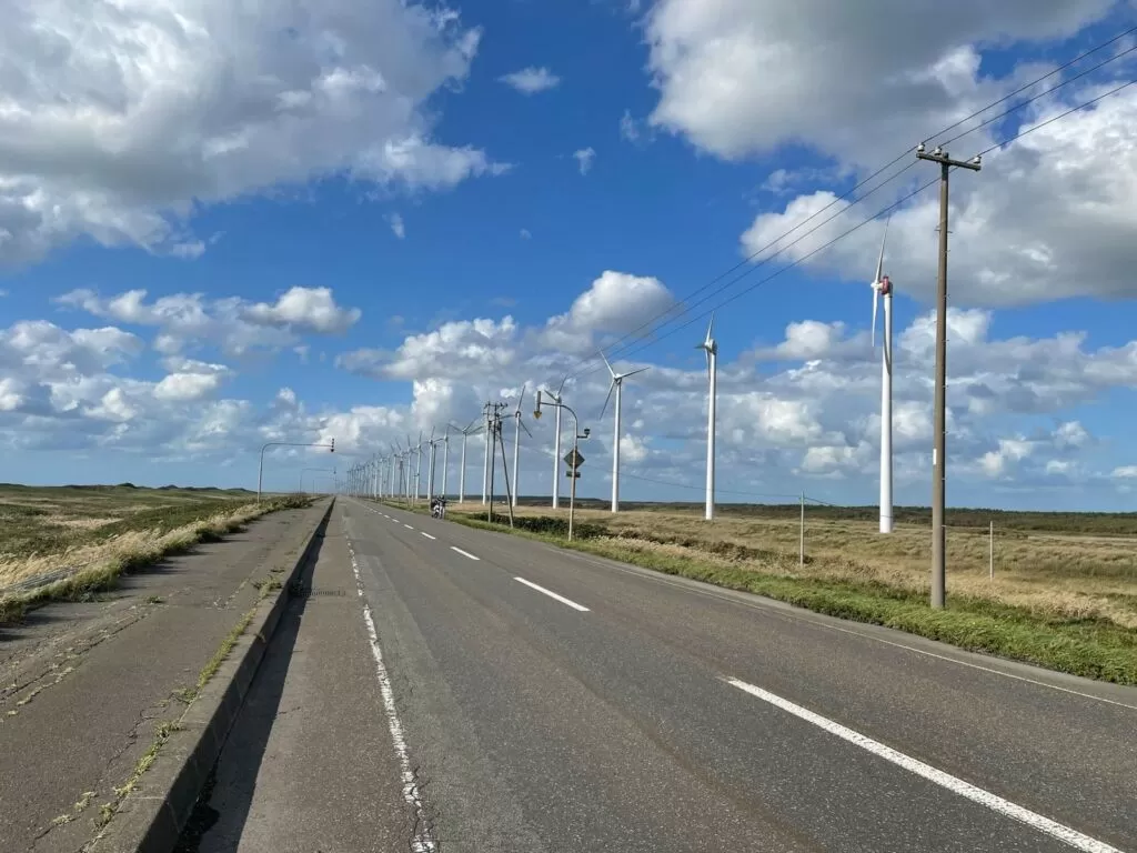
Driving in Hokkaido is on a completely different scale from the rest of Honshu. Single straight roads run for tens of kilometers without a traffic light, and you drive through farmland and pasture that stretch to the horizon, which is something you only get in Hokkaido.
If you want to know how many days a loop of Hokkaido takes, “How many days does it take to drive around Hokkaido?” sets out the basic 10-day, 9-night route from New Chitose Airport, with distances.
Still, because the island is so large, it is easy to get stuck on “which route should I drive?” This article sorts 7 classic Hokkaido drive routes by area, with distances, driving times and stops along the way. It is written so that it works even for a first trip to Hokkaido.
Get a feel for the distances before you set out
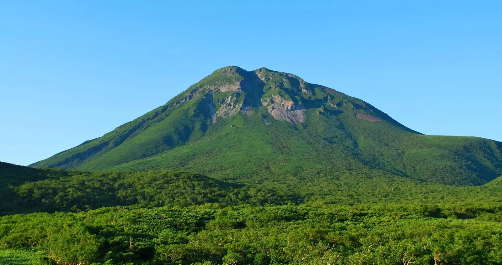
The classic mistake when getting around Hokkaido is trusting the feeling that “it looks close on the map.” Hokkaido is about 550 km from east to west and about 420 km from north to south, and the distances between the main cities are longer than you would expect.
| Section | Distance | Driving time on ordinary roads |
|---|---|---|
| Hakodate–Sapporo | About 280 km | 4–5 hours |
| Sapporo–Asahikawa | About 140 km | 2–2.5 hours |
| Asahikawa–Abashiri | About 180 km | 2.5–3 hours |
| Obihiro–Kushiro | About 120 km | 1.5–2 hours |
| Kushiro–Shiretoko (Shari) | About 130 km | 2 hours |
| Asahikawa–Wakkanai | About 260 km | 3.5–4 hours |
If you keep each day’s drive to 200 km or less (this is this site’s guideline, not an official standard), you keep time to enjoy the scenery. Beyond that, driving eats up your time and sightseeing can’t keep up.
Hokkaido’s roads are also built for speed, which makes it harder to notice you are getting tired. On long driving days, we recommend a break every 2 hours at a Michi-no-Eki roadside station or similar.
The 7 drive routes
Tap a route to zoom in
地図: 国土数値情報(行政区域)・国土地理院 標高タイル。道筋: © OpenStreetMap contributors(OSRM で実際の道を引いたもの)
Drive routes in central Hokkaido | If you start from Sapporo
The times on each route are one example: driving time plus time for sightseeing and breaks. Distances and driving times are estimates from Google Maps directions (October 23, 2026, breaks not included), and information on each spot was checked on the official sites on October 22–23, 2026. Hours and road closures change with the season, so check the official sources before you go. Each day’s driving is split so that it stays within this site’s guideline of 200 km.
① Shakotan Peninsula Ocean Blue Route (Sapporo – Otaru – Shakotan)
Distance: about 220 km | Driving: about 4 h 29 min (excluding breaks) | 2 days, 1 night (stay one night on the Shakotan side) (distance and time are estimates from Google Maps directions, checked on October 23, 2026)
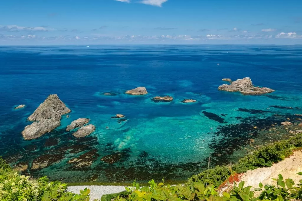
This route runs from Sapporo through Otaru to the tip of the Shakotan Peninsula to see the sea known as Shakotan Blue. Going back to Sapporo the same day would come to more than 220 km, so the plan is built around one night in Shakotan or Yoichi.
Day 1, 9:00 — Leave Sapporo for Otaru
▼How to get from Odori Park to Otaru Canal About 49 min by car, 38.6 km (Google Maps estimate). Open directions in Google Maps
Day 1, 9:50 — Otaru Canal | Walk the warehouse district in the morning
A canal lined with stone warehouses. It gets more crowded toward midday, so a morning visit is easier for walking.
| Inquiries | Otaru City Tourism Promotion Office 0134-32-4111 |
|---|---|
| Tourist information | Otaru Canal Tourist Information Center (5-4 Minato-machi, Otaru). 9:00–18:00, open every day |
| Parking | Otaru International Information Center (5-3 Minato-machi), 91 spaces. ¥300 per hour, maximum ¥1,000 per day |
| Official site | www.city.otaru.lg.jp |
▼How to get from Otaru Canal to Nikka Whisky Yoichi Distillery About 30 min by car, 19.9 km (Google Maps estimate). Open directions in Google Maps
Day 1, 11:00 — Nikka Whisky Yoichi Distillery
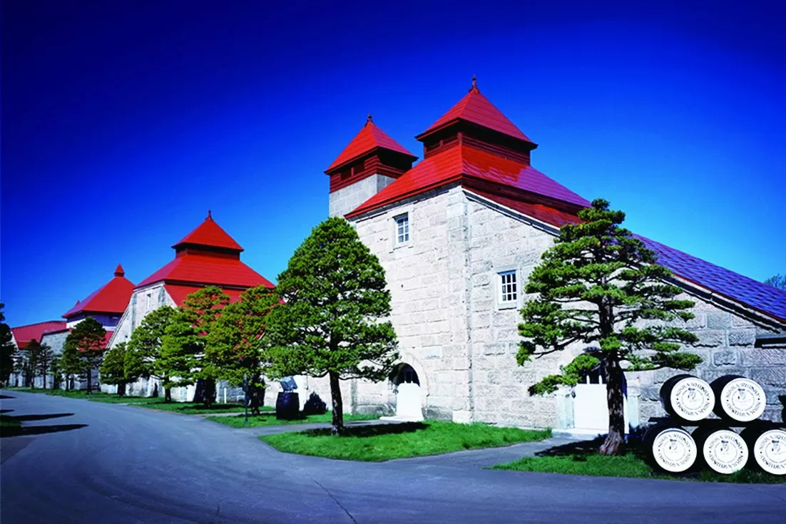
The tour is free, and guided tours are by reservation (Yoichi Tourism Association). Drivers can’t join the tasting, so enjoy it with your passengers taking turns.
| Address | 7-6 Kurokawa-cho, Yoichi-cho, Yoichi-gun, Hokkaido |
|---|---|
| Phone | 0135-23-3131 |
| Hours | 9:00–17:00, closed over the New Year holidays |
| Admission | Free (guided tours by reservation) |
| Official site | yoichi-kankoukyoukai.com |
▼How to get from Nikka Whisky Yoichi Distillery to Shimamui Coast About 50 min by car, 40.8 km (Google Maps estimate). Open directions in Google Maps
Day 1, 12:30 — Shimamui Coast | A cove of Shakotan Blue
From the observation deck past the tunnel, you look down on a clear cove. The path from the deck down to the shore is currently closed to entry (Shakotan Tourism Association). June to August is sea urchin season, and the harbor restaurants serve sea urchin rice bowls.
| Inquiries | Shakotan Town Commerce and Tourism Division 0135-44-3381 |
|---|---|
| Current status | The observation deck is open. The path from the deck down to the shore remains closed to entry. The tunnel and observation deck were closed for winter from December 2025 to March 2026 |
| Official site | www.kanko-shakotan.jp |
▼How to get from Shimamui Coast to Cape Kamui About 20 min by car, 15.1 km (Google Maps estimate). Open directions in Google Maps
Day 1, 14:00 — Cape Kamui | A ridge path leading out past the cliffs
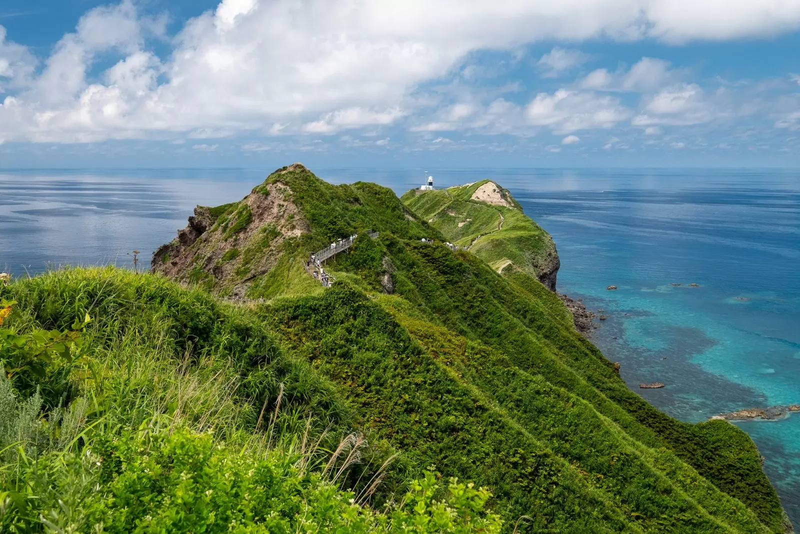
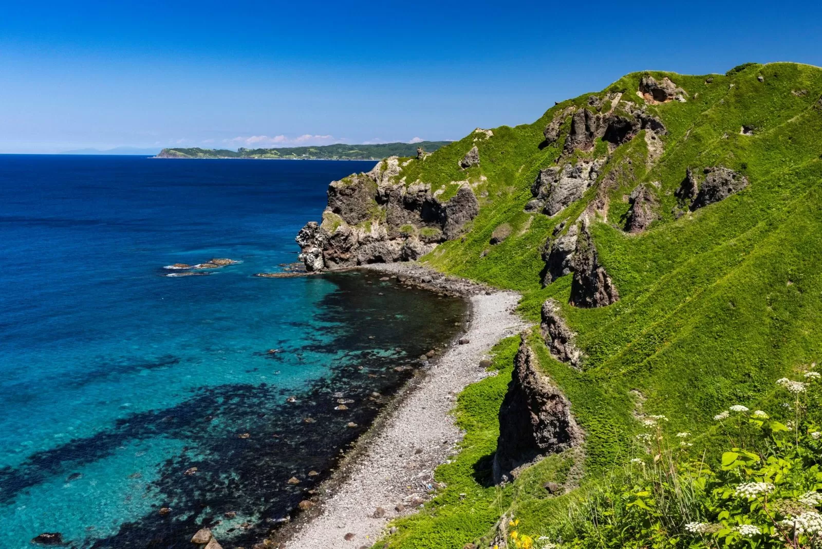
The entrance gate has seasonal opening times, and from December to March it is 10:00–15:00. The walking path to the tip is closed from October 5, 2026 until early April 2027 (planned), so during this period you view the cape from near the entrance (Shakotan Tourism Association). On windy days, take care when opening car doors in the parking lot. Stay one night in Shakotan or Yoichi.
| Address | Kamuimisaki-cho, Shakotan-cho, Shakotan-gun, Hokkaido |
|---|---|
| Inquiries | Shakotan Town Commerce and Tourism Division 0135-44-3381 |
| Entrance gate hours | April 8:00–17:30, May 8:00–18:00, June 8:00–18:30, July 8:00–18:00, August–October 8:00–17:30, November 8:00–16:30, December–March 10:00–15:00 (last entry 1 hour before closing) |
| Closure | The walking path to the tip is closed from October 5, 2026 to early April 2027 (planned) |
| Parking | Parking at Kamuimisaki Natural Park. A warning notes that strong winds often cause accidents where car doors hit neighboring cars |
| Official site | www.kanko-shakotan.jp |
Day 2, 10:00 — Return from Shakotan to Sapporo
▼How to get from Cape Kamui to Odori Park About 2 h by car, 106 km (Google Maps estimate). Head back along National Route 229 by the sea. Open directions in Google Maps
② Lake Toya and Niseko Route (Sapporo – Niseko – Lake Toya)
Distance: about 285 km | Driving: about 4 h 56 min (excluding breaks) | 2 days, 1 night (stay one night at Toyako Onsen) (distance and time are estimates from Google Maps directions, checked on October 23, 2026)
This route leaves Sapporo, crosses Nakayama Pass, and loops through Niseko and Lake Toya before returning. Doing it in one day comes to about 285 km, so you stay one night at Toyako Onsen.
Day 1, 9:00 — Leave Sapporo for Nakayama Pass
▼How to get from Odori Park to Nakayama Pass (Michi-no-Eki Boyo Nakayama) About 1 h 12 min by car, 45.1 km (Google Maps estimate). Open directions in Google Maps
Day 1, 10:15 — Nakayama Pass (Michi-no-Eki Boyo Nakayama) | A break with fried potatoes
A Michi-no-Eki on the pass between Sapporo and the foot of Mt. Yotei. Take a break here with its famous fried potatoes (ageimo).
| Address | 345 Kawakami, Kimobetsu-cho, Abuta-gun, Hokkaido (along National Route 230) |
|---|---|
| Phone | 0136-33-2671 |
| Shop hours | April–October 8:30–17:30, November–March 9:00–17:00. Open year-round |
| Official site | ageimo.com |
▼How to get from Nakayama Pass (Michi-no-Eki Boyo Nakayama) to Michi-no-Eki Niseko View Plaza About 47 min by car, 43.1 km (Google Maps estimate). Open directions in Google Maps
Day 1, 11:30 — Michi-no-Eki Niseko View Plaza | Mt. Yotei and the farm stand
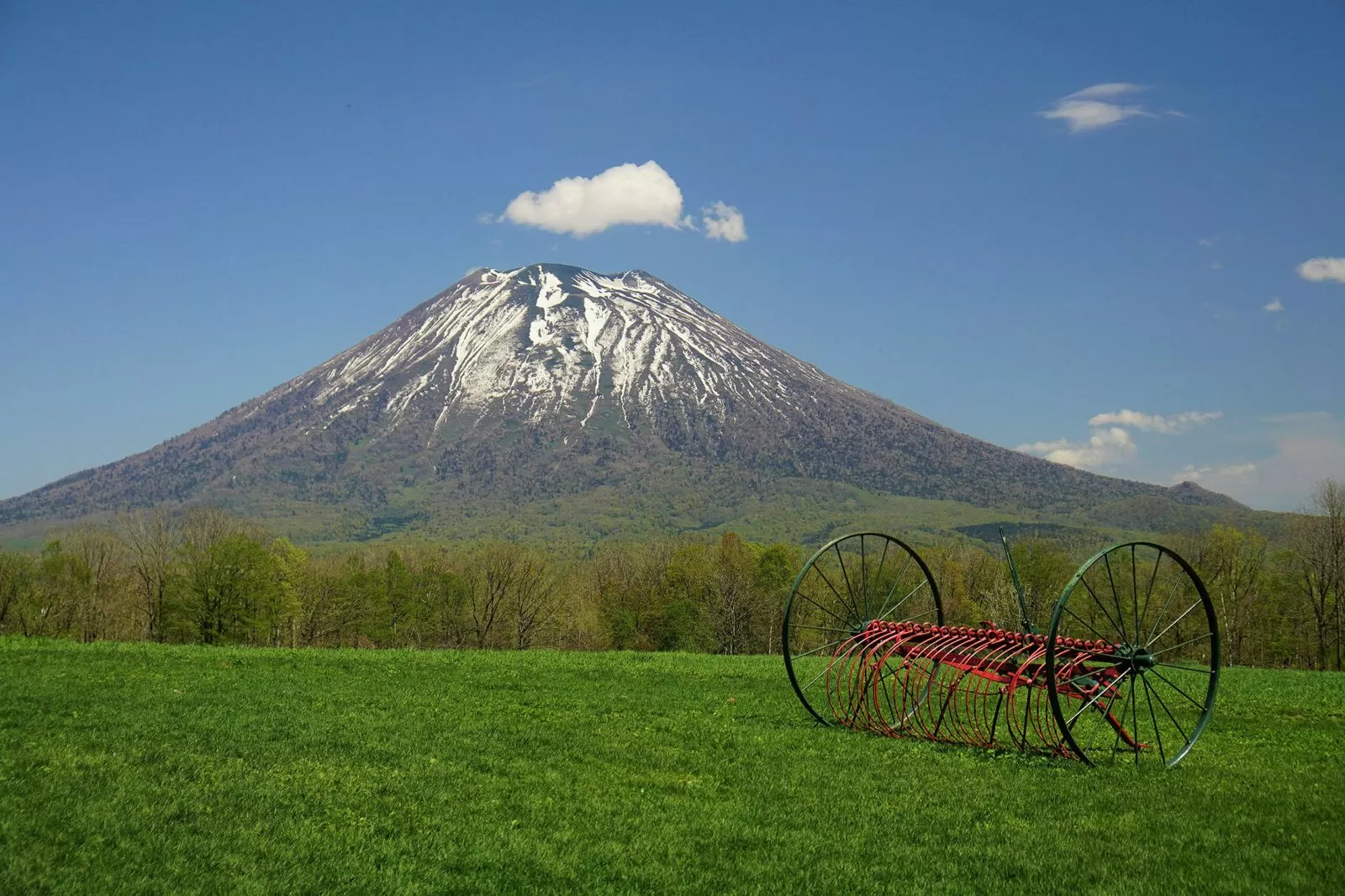
A Michi-no-Eki at the foot of Mt. Yotei with a farm stand selling local vegetables.
| Address | 77-10 Motomachi, Niseko-cho, Abuta-gun, Hokkaido 048-1544 |
|---|---|
| Phone | 0136-44-3433 |
| Farm stand hours | Summer 8:30–17:00, winter 9:00–17:00. Closed December 31–January 3 |
| Official site | niseko-viewplaza.jp |
▼How to get from Michi-no-Eki Niseko View Plaza to Toyako Onsen About 46 min by car, 40.9 km (Google Maps estimate). Open directions in Google Maps
Day 1, 14:00 — Toyako Onsen | One night by the lake
The area around Lake Toya is a hot spring resort with many facilities offering day-use baths. Michi-no-Eki “Toyako” on the lakeshore stands right in front of the lake and has lovely views from the evening on. If you plan to use it for overnight parking, arriving around 5 p.m. makes it easier to secure a parking space.
| Address | 142 Toyako Onsen, Toyako-cho, Abuta-gun, Hokkaido 049-5721 |
|---|---|
| Phone | 0142-75-2446 |
| Hours | 9:00〜17:00 |
| Official site | www.laketoya.com |
▼How to get from Toyako Onsen to Mt. Usu Ropeway About 10 min by car, 6.5 km (Google Maps estimate). Leave at 9:30 on the morning of Day 2. Open directions in Google Maps
Day 2, 9:45 — Mt. Usu Ropeway | Look down into the crater
A ropeway that climbs from beside Showa-Shinzan to the summit of Mt. Usu. It is suspended for inspection on some days in January and February, so in winter check the operating days before you go.
| Address | 184-5 Showa-Shinzan, Sobetsu-cho, Usu-gun, Hokkaido 052-0102 |
|---|---|
| Phone | 0142-75-2401 |
| Admission | Round trip: adults ¥2,000, elementary school students ¥1,000 |
| Suspended | Suspended on some days in January and February for regular inspection (dates change every year) |
| Parking | 400 cars, ¥500 per day |
| Official site | usuzan.hokkaido.jp |
▼How to get from Mt. Usu Ropeway to Odori Park About 2 h 1 min by car, 149 km (Google Maps estimate). If you leave before noon, you can be back in Sapporo before sunset. Open directions in Google Maps
Drive routes in northern Hokkaido | Heading for the scenic straight roads
③ Furano and Biei Flower Road (Asahikawa – Biei – Furano)
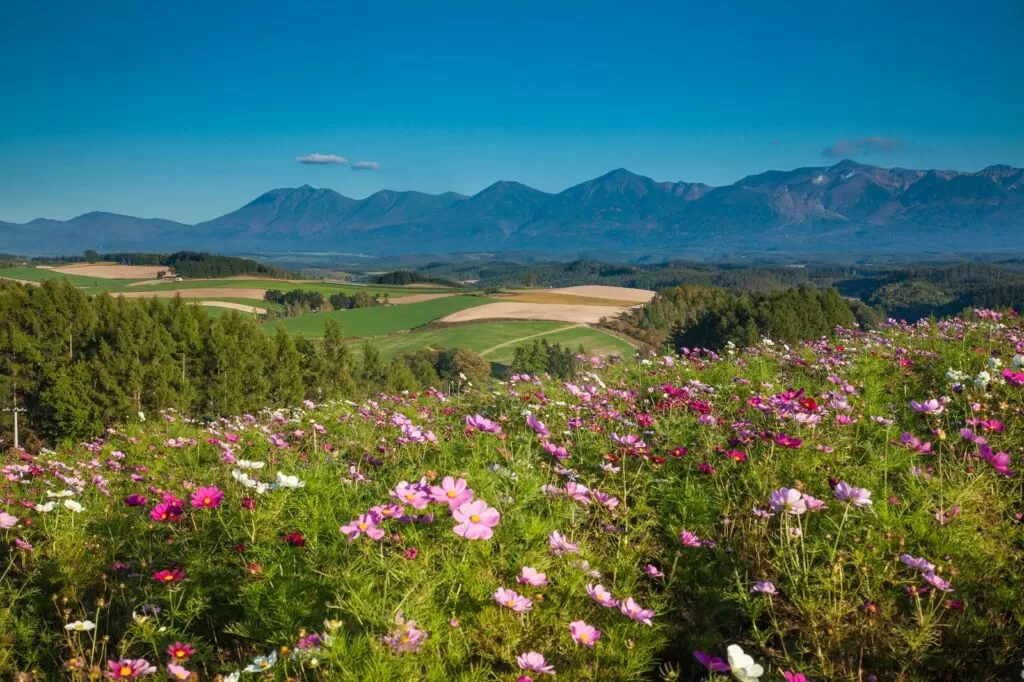
Distance: about 140 km | Driving: about 2 h 56 min (excluding breaks) | Day trip (distance and time are estimates from Google Maps directions, checked on October 23, 2026)
This route heads south from Asahikawa and loops through Biei, known for its patchwork hills, and Furano, with its lavender fields. The distance is short, but there are many farms, hills and farm stands worth stopping at, so it works as half a day or a full day.
If you are building your trip around Asahikawa, it also helps to check campervan rental comparison in the Asahikawa area.
9:00 — Leave Asahikawa Station for the hills of Biei
▼How to get from Asahikawa Station to Hokusei-no-Oka Observation Park About 30 min by car, 22.1 km (Google Maps estimate). Open directions in Google Maps
9:30 — Hokusei-no-Oka Observation Park | Look out over the patchwork hills
An observation park overlooking the “patchwork hills,” where fields of wheat, potatoes and beans line up in blocks of color.
| Address | Okubo Kyosei, Biei-cho, Kamikawa-gun, Hokkaido |
|---|---|
| Inquiries | 0166-92-4378 (Biei Town Tourism Association) |
| Admission | Free |
| Parking | 30 cars and 5 buses, plus a second lot below the observation deck (10 cars). Free. The lots can fill up on busy days |
| Winter | The observation deck is closed when snow is on the ground because it is slippery. No toilets in winter |
| Official site | www.biei-hokkaido.jp |
▼How to get from Hokusei-no-Oka Observation Park to Shirogane Blue Pond About 24 min by car, 18.5 km (Google Maps estimate). Open directions in Google Maps
10:30 — Shirogane Blue Pond
A pond that changes color with the weather and season. Parking fees for campervans depend on overall length, so see the table below.
| Inquiries | 0166-92-4378 (Biei Town Tourism Association) |
|---|---|
| Parking fee | Standard cars ¥1,000. Vehicles 6 m or longer are treated as large vehicles at ¥6,000, with a separate entrance (from July 1, 2026) |
| Official site | www.biei-hokkaido.jp |
▼How to get from Shirogane Blue Pond to Farm Tomita About 30 min by car, 24.3 km (Google Maps estimate). Open directions in Google Maps
11:30 — Farm Tomita | Lavender fields
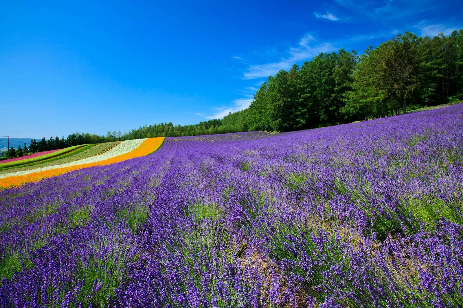
Lavender is at its best from early to mid July, and the parking lot can fill up in the morning at that time. Overnight parking is prohibited in the lot, and the official site asks campervans to use nearby town-run parking lots and similar places.
| Address | Kisen Kita 15-go, Nakafurano-cho, Sorachi-gun, Hokkaido 071-0704 |
|---|---|
| Phone | 0167-39-3939 |
| Admission | Admission and parking are both free |
| Example hours | Late June–mid August 8:30–17:30, December–early April 10:00–16:00 (varies by season) |
| Parking | About 500 cars (only during opening hours). Overnight parking is prohibited. Campervans are asked to use nearby town-run parking lots and similar places |
| Official site | www.farm-tomita.co.jp |
▼How to get from Farm Tomita to Furano Cheese Factory About 21 min by car, 13.4 km (Google Maps estimate). Open directions in Google Maps
13:30 — Furano Cheese Factory | A tour and lunch
There is a cheese workshop and a pizza workshop. Admission is free.
| Address | Chugo, Furano City, Hokkaido |
|---|---|
| Phone | 0167-23-1156 |
| Hours | April 1–October 31 9:00–17:00, November 1–March 31 9:00–16:00 |
| Closed | December 31–January 3, and every Monday in January and February |
| Admission | Free admission (hands-on workshops are generally booked online) |
| Parking | Free, 120 spaces |
| Official site | www.furano-cheese.jp |
▼How to get from Furano Cheese Factory to Asahikawa Station About 1 h 11 min by car, 62.1 km (Google Maps estimate). You can be back in Asahikawa early in the evening. Open directions in Google Maps
④ Northern Hokkaido and Cape Soya Route (Asahikawa – Sarobetsu – Wakkanai)
Distance: about 313 km | Driving: about 5 h 7 min (excluding breaks) | 3 days, 2 nights (stay in Bifuka and Wakkanai) (distance and time are estimates from Google Maps directions, checked on October 23, 2026)
This route heads north from Asahikawa on National Route 40 toward Cape Soya, the northernmost point in Japan. Asahikawa to Otonrui alone is about 200 km, so you stay in Bifuka on Day 1 and head north along the coast on Day 2.
Day 1, 13:00 — Asahikawa Station to Bifuka
▼How to get from Asahikawa Station to Michi-no-Eki Bifuka (Bifuka) About 1 h 43 min by car, 107 km (Google Maps estimate). Stay overnight in Bifuka. Open directions in Google Maps
Day 2, 9:00 — Bifuka to the Sea of Japan coast
▼How to get from Michi-no-Eki Bifuka (Bifuka) to Otonrui Wind Farm About 1 h 26 min by car, 91.5 km (Google Maps estimate). Open directions in Google Maps
Day 2, 10:30 — Otonrui Wind Farm | 28 wind turbines along the coast
Along Hokkaido Route Wakkanai-Teshio, 28 wind turbines stand in a line 3.1 km long from north to south (Horonobe). It is not a visitor facility, so you view it from the roadside. When you park, pull into a wide spot and watch for vehicles behind you.
▼How to get from Otonrui Wind Farm to Sarobetsu Mire Center About 19 min by car, 20.1 km (Google Maps estimate). Open directions in Google Maps
Day 2, 11:00 — Sarobetsu Mire Center | A boardwalk across the wetland
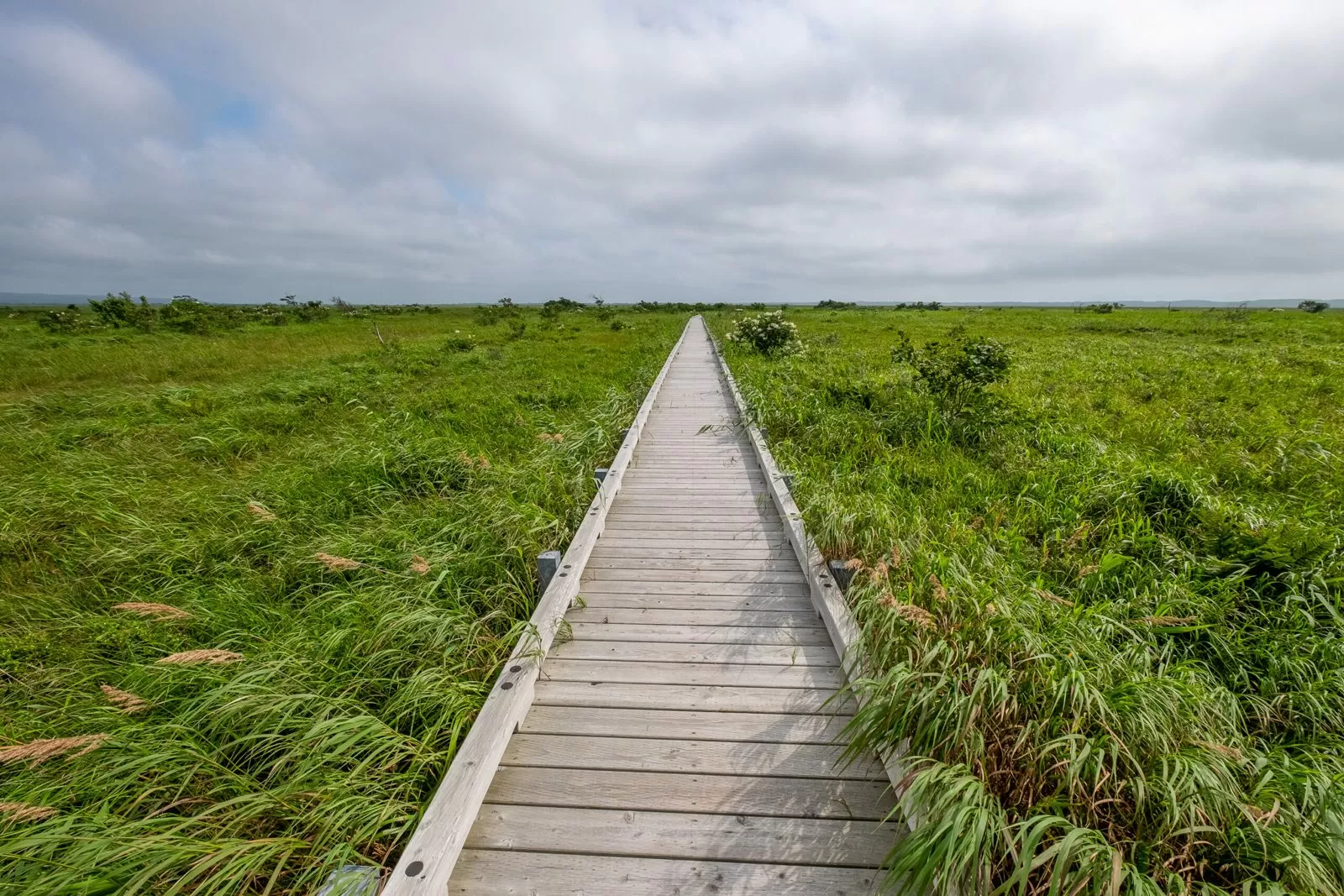
You can walk the wetland on a boardwalk of about 1 km for the full loop. The boardwalk is open 24 hours. Pets are not allowed in.
| Address | 8662 Kami-Sarobetsu, Toyotomi-cho, Teshio-gun, Hokkaido 098-4100 |
|---|---|
| Phone | 0162-82-3232 |
| Opening hours | May–October 9:00–17:00, November–April 10:00–16:00 (boardwalk 24 hours) |
| Closed | Open every day May–October; November–April closed Mondays and December 29–January 3 |
| Parking | Available |
| Official site | sarobetsu.or.jp |
▼How to get from Sarobetsu Mire Center to Cape Soya About 1 h 1 min by car, 62.3 km (Google Maps estimate). Open directions in Google Maps
Day 2, 14:00 — Cape Soya | The northernmost point in Japan
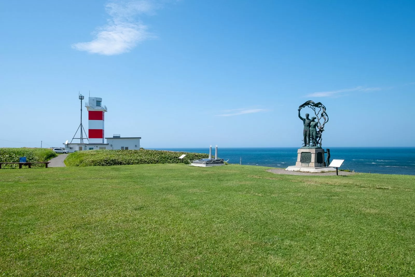
A cape with a monument marking the northernmost point in Japan (Wakkanai). You stay in Wakkanai. Ferries to Rishiri and Rebun islands also leave from Wakkanai.
▼How to get from Cape Soya to Wakkanai Park About 38 min by car, 32.2 km (Google Maps estimate). Stop here on the morning of Day 3. Open directions in Google Maps
Day 3, 9:00 — Wakkanai Park | Look down on the city and the sea
Wakkanai’s main city park, selected as a Japan Night View Heritage site (Wakkanai). The return to Asahikawa is about 260 km, so either stay one night on the way or split the trip over 2 days.
Drive routes in eastern Hokkaido | The most Hokkaido-like place of all
⑤ Eastern Hokkaido Great Nature Route (Obihiro – Kushiro – Shiretoko)
Distance: about 352 km | Driving: about 5 h 46 min (excluding breaks) | 3 days, 2 nights (stay in Kushiro and around Nakashibetsu or Shibetsu) (distance and time are estimates from Google Maps directions, checked on October 23, 2026)
This route runs from the broad farmland around Obihiro, through the Kushiro Wetland, to the Shiretoko Peninsula. The scenery changes a lot, and it suits anyone who wants to take in Hokkaido’s nature all at once.
If you are starting with the Obihiro and Tokachi campervan drive guide, the Obihiro and Tokachi campervan rental comparison is also worth a look.
Day 1, 10:00 — Obihiro | Ban’ei horse racing
Obihiro is a town with many butadon (pork rice bowl) restaurants. At Obihiro Racecourse, Ban’ei racing, in which horses pull heavy sleds, is held on Saturdays, Sundays and Mondays that are public holidays, and admission is free for the time being.
| Address | 9-chome Nishi 13-jo Minami, Obihiro 080-0023 |
|---|---|
| Phone | 0155-34-0825 |
| Race days | Saturdays, Sundays and Mondays that are public holidays (see the official schedule for daily times) |
| Admission | Free for the time being |
| Parking | 400 spaces, free |
| Official site | www.banei-keiba.or.jp |
▼How to get from Obihiro Station to Kushiro-shi Shitsugen Observatory About 1 h 44 min by car, 118 km (Google Maps estimate). Leave Obihiro in the early afternoon. Open directions in Google Maps
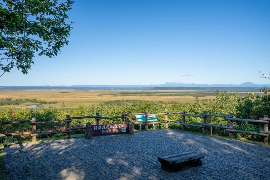
Day 1, 15:00 — Kushiro-shi Shitsugen Observatory | Japan’s largest wetland
An observatory overlooking the Kushiro Wetland (inquiries 0154-56-2424, Kushiro City). Stay in Kushiro.
▼How to get from Kushiro-shi Shitsugen Observatory to Notsuke Peninsula Nature Center About 2 h 15 min by car, 133 km (Google Maps estimate). Leave at 9:00 on the morning of Day 2. Open directions in Google Maps
Day 2, 11:30 — Notsuke Peninsula Nature Center | A long, thin peninsula of sand
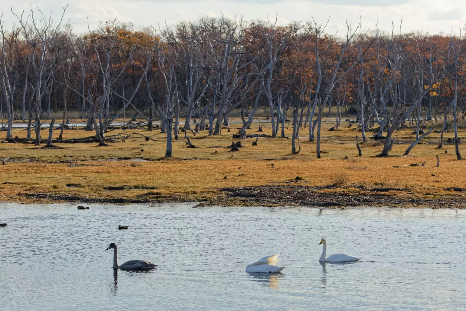
A long, narrow sand peninsula reaching out into the sea, where you can see the dead trees of Narawara and Todowara. Admission to the nature center is free. Stay nearby in Nakashibetsu or Shibetsu.
| Address | 63 Notsuke, Betsukai-cho, Notsuke-gun, Hokkaido 086-1645 |
|---|---|
| Phone | 0153-82-1270 |
| Opening hours | April–September 9:00–17:00, October–March 9:00–16:00. Closed December 30–January 5 |
| Admission | Free admission |
| Parking | 50 cars and 10 buses |
| Official site | www.notsuke.jp |
▼How to get from Notsuke Peninsula Nature Center to Shiretoko Five Lakes About 1 h 47 min by car, 101 km (Google Maps estimate). Leave on the morning of Day 3. Open directions in Google Maps
Day 3, 11:00 — Shiretoko Five Lakes | The lakes of a World Natural Heritage site
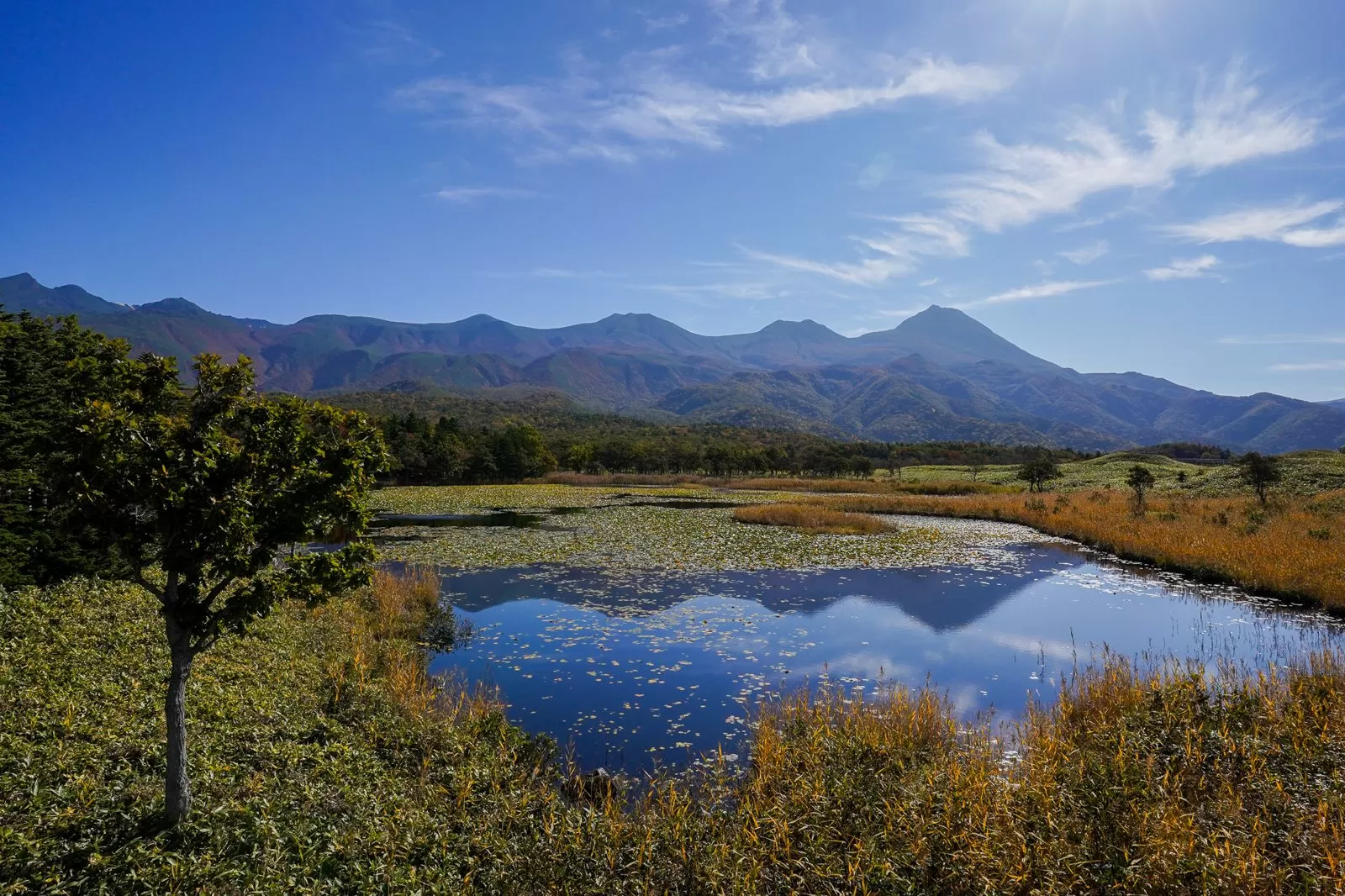
The elevated boardwalk is free and needs no procedure. For the ground trail, a lecture or a guided tour is required depending on the period (Shiretoko Five Lakes Field House). The park is open April 20–November 8 (2026), and the ground trail closes when brown bears appear.
Route 93, the road to nearby Kamuiwakka Falls, is closed for winter from October 1, 2026 to June 1, 2027, and you cannot pass even on foot. Since 2023 the falls have become a reservation-only experience that climbs up to the fourth fall (Shiretoko Shari Town Tourism Association). The Shiretoko Cross-Country Road linking Utoro and Rausu is also closed because of freezing as of October 23.
| Inquiries | Shiretoko Five Lakes Field House 0152-24-3323 |
|---|---|
| Elevated boardwalk | Free and no procedure needed, from opening to closing |
| Ground trail | From opening to May 9 and from August 1 to closing, a lecture (adults ¥450); from May 10 to July 31, joining a guided tour is required |
| Open season | April 20–November 8 in 2026 |
| Parking | About 100 spaces, paid |
| Official site | www.goko.go.jp |
The Shiretoko area is a stretch of road where Yezo deer appear more often than almost anywhere in Hokkaido. After dusk they often leap out suddenly from the roadside, so you need to slow down after sunset. The elevated boardwalk at Shiretoko Five Lakes has a closing time, so take care not to arrive right at the last minute in the evening.
⑥ Okhotsk Coast Route (Abashiri – Monbetsu)
Distance: about 120 km | Driving: about 2 h 13 min (excluding breaks) | Day trip (distance and time are estimates from Google Maps directions, checked on October 23, 2026)
This route follows National Route 238 (the Okhotsk Line) from Abashiri. Straight roads run along the sea, and you drive to Monbetsu, stopping at the drift ice museum, the glasswort colony and other spots on the way.
9:00 — Okhotsk Drift Ice Museum | Touch real drift ice

An exhibition hall on Mt. Tento in Abashiri, with a room where you can touch real drift ice.
| Address | 244-3 Tentozan, Abashiri, Hokkaido 093-0044 |
|---|---|
| Phone | 0152-43-5951 |
| Opening hours | May–October 8:30–18:00, November–April 9:00–16:30 (December 29–January 5 is 10:00–15:00) |
| Admission | Adults ¥990, high school students ¥880, elementary and junior high school students ¥770 |
| Parking | 150 cars |
| Official site | www.ryuhyokan.com |
▼How to get from Okhotsk Drift Ice Museum to Uryunai Glasswort Colony About 17 min by car, 13.8 km (Google Maps estimate). Open directions in Google Maps
10:30 — Uryunai Glasswort Colony | A lakeshore that turns red in autumn
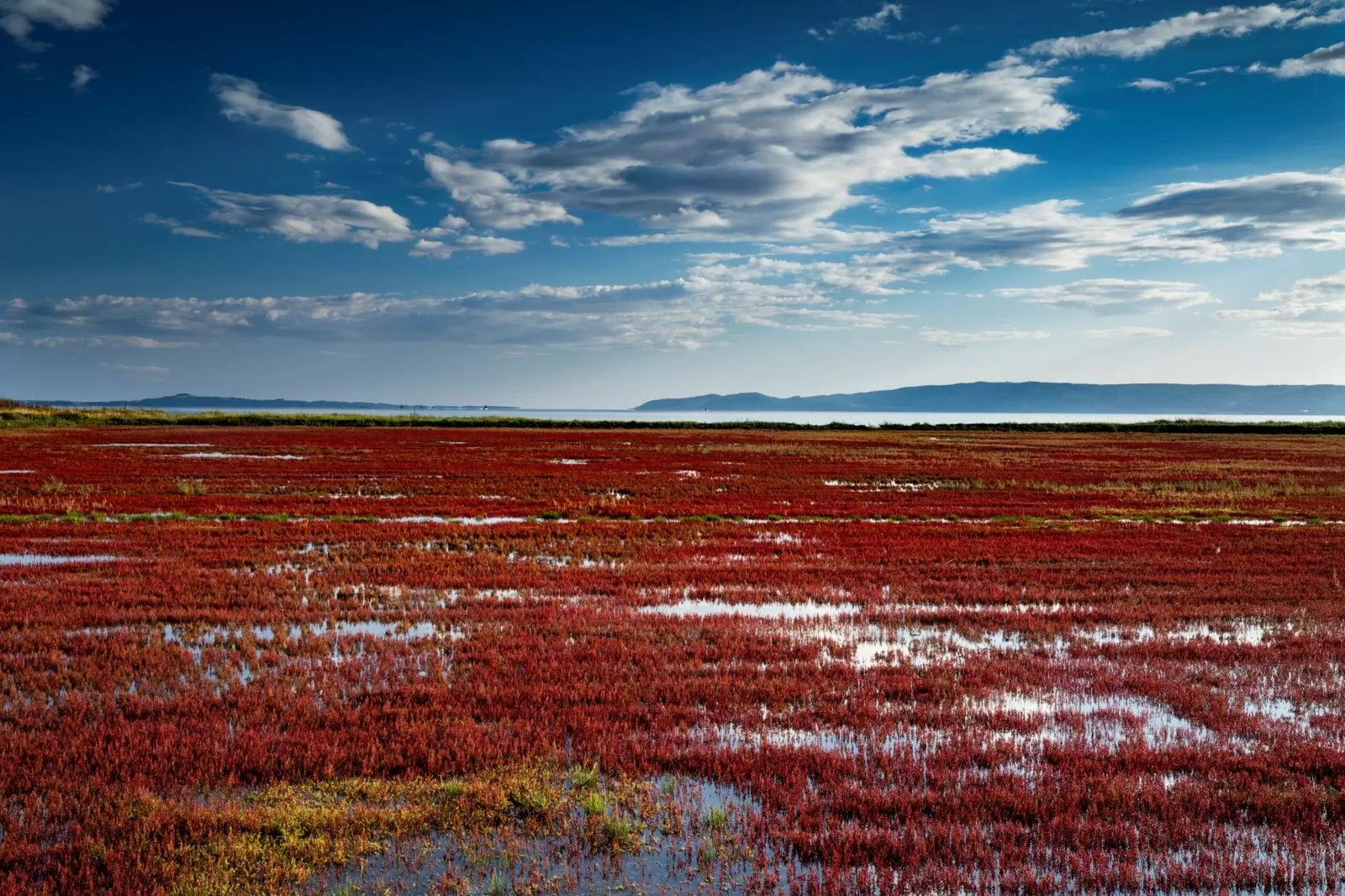
On the shore of Lake Notoro, glasswort (sangosou) turns red around September.
▼How to get from Uryunai Glasswort Colony to Lake Saroma Observatory About 49 min by car, 44.5 km (Google Maps estimate). Open directions in Google Maps
11:45 — Lake Saroma Observatory | The lake and the Sea of Okhotsk at once
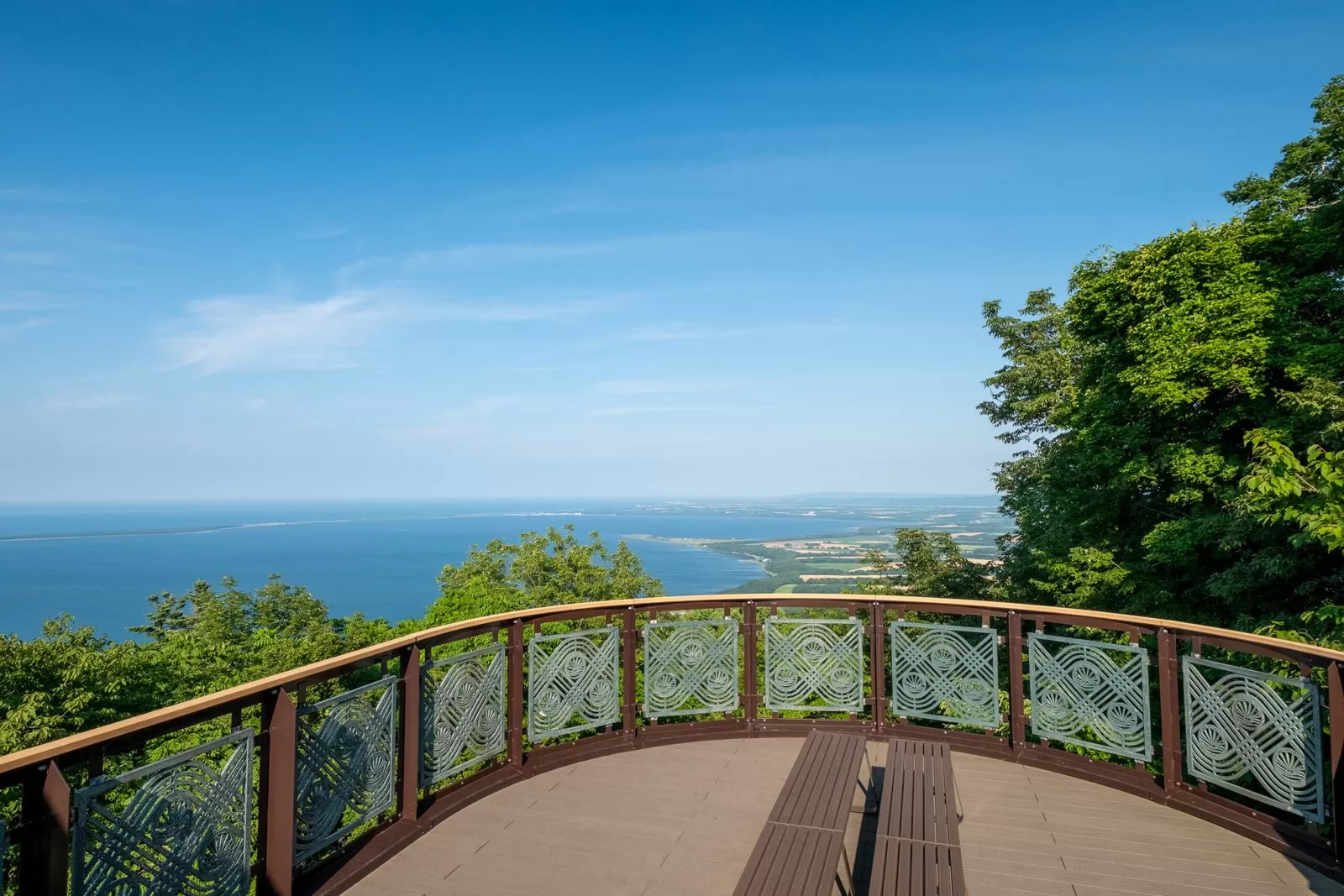
| Inquiries | Saroma Town Economy Division, Commerce and Tourism Section 01587-2-1200 |
|---|---|
| Driving access | The road to the observatory is one-way. Enter from the east-side entrance on National Route 238 |
| Brown bears | A bear appeared on September 26, 2026, and the hiking path was closed to climbers. It was lifted on October 15 (visitors are advised to carry bear bells and similar). You can still drive to the observatory |
| Official site | www.town.saroma.hokkaido.jp |
▼How to get from Lake Saroma Observatory to Garinko Station (Monbetsu) About 1 h 7 min by car, 61.4 km (Google Maps estimate). Open directions in Google Maps
13:30 — Monbetsu | Garinko-go, the icebreaker sightseeing ship
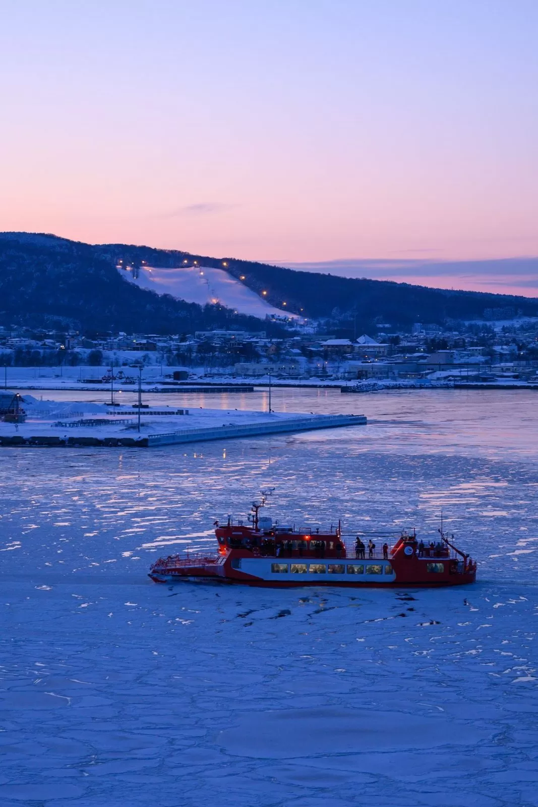
A sightseeing boat that breaks through drift ice as it goes. In winter 2027 it runs daily from January 15 to March 31.
| Boarding point | 1 Kaiyo-koen, Monbetsu, Hokkaido 094-0031 (Kaiyo Koryu-kan) |
|---|---|
| Reservations | 050-1743-5848 |
| Winter 2027 operation | January 15–March 31, daily |
| Fare (winter 2027) | Adults: January and March ¥5,000, February ¥6,000. Elementary school students half price |
| Parking | Free |
| Official site | www.o-tower.co.jp |
If you drive in the winter drift ice season (January–March), you may see drift ice close up against the roadside. Winter roads freeze, though, so studless tires and 4WD are a must.
Drive routes in southern Hokkaido | History and seafood
⑦ Hakodate – Onuma – Lake Toya (Southern Hokkaido Route)
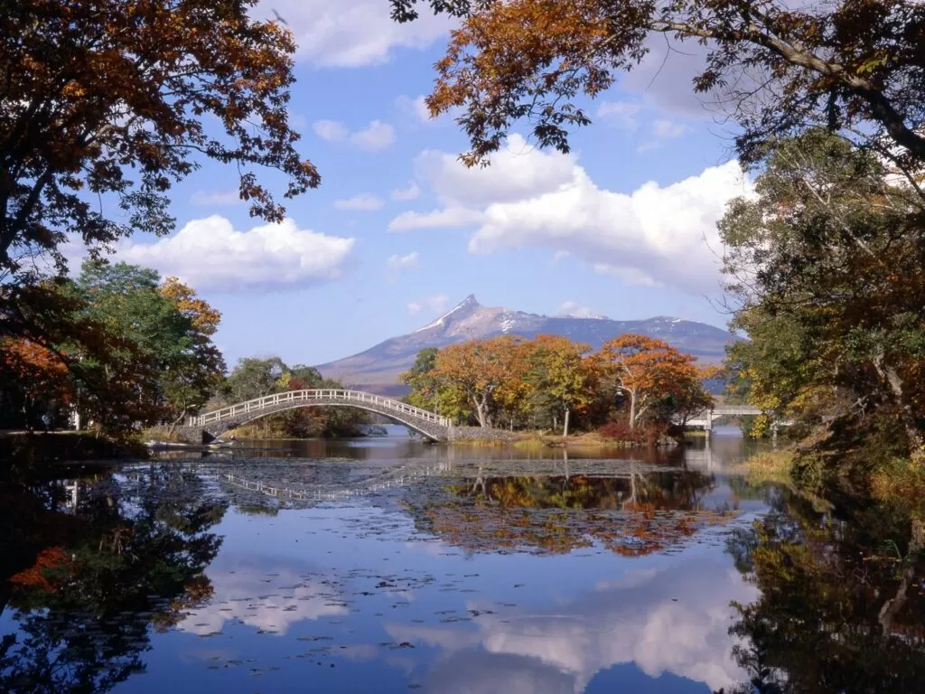
Distance: about 173 km | Driving: about 2 h 45 min (excluding breaks) | Day trip to 1 night (distance and time are estimates from Google Maps directions, checked on October 23, 2026)
This route starts in Hakodate and runs via National Route 5 and the Onuma Kokudo road to Lake Toya. It is an easy first route for anyone who arrives in Hakodate by ferry.
If you are building your trip from Hakodate and southern Hokkaido, it is also handy to look at the Hakodate campervan rental comparison.
7:00 — Hakodate Morning Market | Seafood rice bowl for breakfast
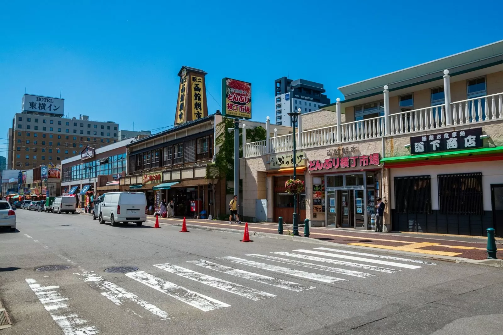
It opens at 5 a.m. from May to December and at 6 a.m. from January to April. If you spend ¥2,200 or more at member shops, parking is free for 60 minutes.
| Address | 9-19 Wakamatsu-cho, Hakodate, Hokkaido 040-0063 (Hakodate Morning Market Cooperative Association) |
|---|---|
| Phone | 0138-22-7981 |
| Hours | January–April 6:00 to a little after 14:00, May–December 5:00 to a little after 14:00 (varies by shop) |
| Parking | About 350 spaces (including the surrounding area). Normally ¥100 per 20 minutes. Free for 60 minutes if you spend ¥2,200 or more at member shops |
| Official site | www.hakodate-asaichi.com |
▼How to get from Hakodate Morning Market to Mt. Hakodate Ropeway About 9 min by car, 3.1 km (Google Maps estimate). Open directions in Google Maps
10:00 — Mt. Hakodate Ropeway | The city of Hakodate from the summit
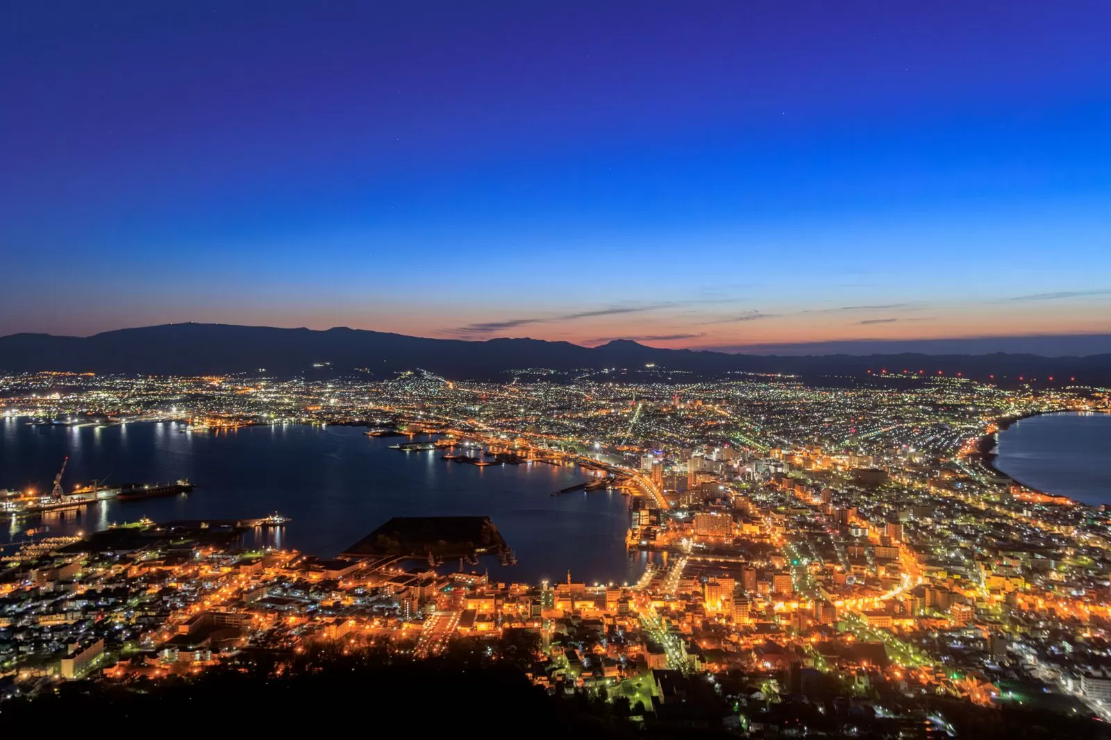
It runs from 10 a.m. It is suspended for inspection from October 20 to November 8, 2026, and the mountain road up to the summit by car closes for winter from November 9.
| Address | 19-7 Motomachi, Hakodate, Hokkaido 040-0054 |
|---|---|
| Phone | 0138-23-3105 |
| Hours | April 20–September 30 10:00–22:00, October 1–April 19 10:00–21:00 (last ascent 30 minutes before closing) |
| Admission | Round trip: adults ¥1,800, children ¥900 |
| Suspended | Suspended all day for inspection from October 20 to November 8, 2026 |
| By car to the summit | The mountain road is closed for winter from November 9, 2026 to April 12, 2027 (planned). In summer, private cars are restricted at night |
| Official site | 334.co.jp |
▼How to get from Mt. Hakodate Ropeway to Onuma Quasi-National Park About 47 min by car, 32.7 km (Google Maps estimate). Open directions in Google Maps
12:00 — Onuma Quasi-National Park | A lake of Mt. Komagatake and small islands
A lake 47 minutes by car from Mt. Hakodate, where small islands float with Mt. Komagatake behind them. You can also canoe or cycle.
| Address | 85-15 Onuma-cho, Nanae-cho, Kameda-gun, Hokkaido (next to JR Onuma-koen Station) |
|---|---|
| Phone | 0138-67-2170 |
| Hours | 9:00–17:00, closed over the New Year holidays |
| Parking | 15 spaces in the Plaza lot |
| Official site | guruttoonuma.net |
Volcano information for Hokkaido-Komagatake (checked October 8, 2026) Hokkaido-Komagatake has been at Volcanic Alert Level 2 (restricted area around the crater) since October 2, 2026. Do not enter the area within about 4 km of the crater. Refrain from climbing, and check the guidance from Nanae, Mori and Shikabe towns and the Japan Meteorological Agency’s volcano information for Hokkaido-Komagatake. The Onuma Park lakeshore, outside the restricted area, can still be visited as before.
▼How to get from Onuma Quasi-National Park to Toyako Onsen About 1 h 49 min by car, 137 km (Google Maps estimate). You drive along Uchiura Bay (Funka Bay). Stay overnight at Toyako Onsen. Open directions in Google Maps
New Chitose Airport / Tokachi-Obihiro Airport
Rent the Cabcon “Cresson Journey”
Base yourself at New Chitose Airport and compare rates, vehicle types, and pickup locations all in one place.
See details at Moving Inn →Driving around Hokkaido | How far and how many days if you link the 7 routes?
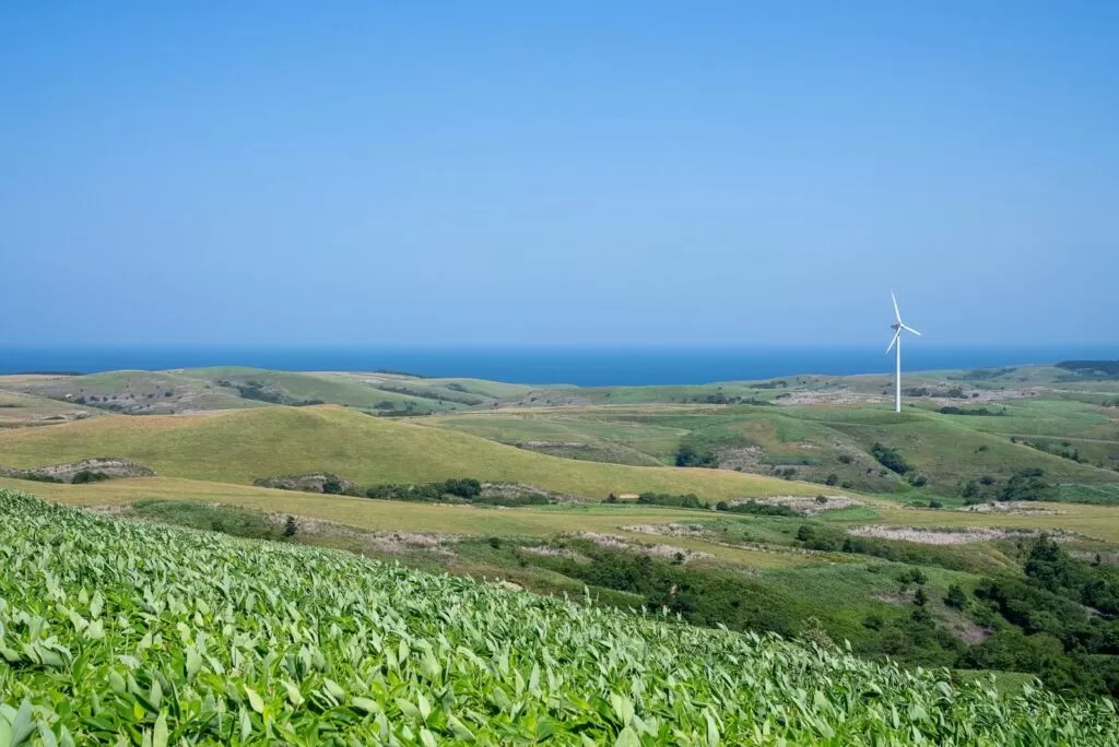
Each of the 7 routes above can be driven in anything from a day trip to 3 days and 2 nights. Link them into one and you have a drive around Hokkaido. Keeping to 200 km a day (this site’s guideline), a loop from New Chitose Airport comes to about 2,090 km and a minimum of 12 nights and 13 days (How many days does it take to drive around Hokkaido?). More detailed day-by-day routes are collected in the sister article “Complete Guide to Hokkaido Campervan Model Courses.” The two articles divide the work: this one introduces the highlights of each area, while the model course article covers concrete itineraries down to each day’s overnight parking spots and travel distances.
Using the place names from the 7 routes as they are and rearranging them in the order you would drive them on a loop, you get the table below. Starting from Hakodate, it heads north along the Sea of Japan side, passes Cape Soya, and then goes around the Okhotsk coast and eastern Hokkaido. It is the same “counterclockwise” flow as the model course in the sister article. The Shakotan Peninsula, Furano and Biei are sections a little off the main roads, so if you are short on days, you can also choose to save them for another trip.
| Order | Route (in this article) | Main stops | Approx. distance of this route |
|---|---|---|---|
| 1 | ⑦ Hakodate – Onuma – Lake Toya (southern Hokkaido) | Hakodate Morning Market, Onuma Quasi-National Park, Lake Toya | About 173 km |
| 2 | ② Lake Toya and Niseko Route (central Hokkaido) | Michi-no-Eki Boyo Nakayama, Niseko, Mt. Usu Ropeway | About 285 km (1 night) |
| 3 | ① Shakotan Peninsula Ocean Blue Route (central Hokkaido) | Otaru Canal, Yoichi, Cape Shakotan, Cape Kamui | About 220 km (round trip from Sapporo, 1 night) |
| 4 | ③ Furano and Biei Flower Road (northern Hokkaido) | Blue Pond, Farm Tomita | About 140 km |
| 5 | ④ Northern Hokkaido and Cape Soya Route (northern Hokkaido) | Sarobetsu Mire Center, Cape Soya | About 313 km (from Asahikawa, 2 nights) |
| 6 | ⑥ Okhotsk Coast Route (eastern Hokkaido) | Okhotsk Drift Ice Museum, Lake Notoro, Lake Saroma Observatory | About 120 km |
| 7 | ⑤ Eastern Hokkaido Great Nature Route (eastern Hokkaido) | Kushiro Wetland Observatory, Shiretoko Five Lakes | About 352 km (2 nights) |
Added up as they are, the distances of the 7 routes come to about 1,600 km (a value checked on Google Maps on October 23, 2026). On an actual loop, travel between routes is added, and at up to 200 km a day it comes to about 2,090 km and a minimum of 12 nights and 13 days. If you want to check the overnight parking spots and daily travel distances, please refer to that article.
There is also a way to test how many days you can drive safely, while playing. This site’s Hokkaido Sugoroku is a game in which you drive a loop (about 2,090 km) connecting 29 real RV parks by real roads from New Chitose Airport, with limits of 200 km and 9 hours a day. If you stay within those limits, driving alone takes a minimum of 11 days. Add detours and sightseeing days and it gets longer still. Try it once to see whether the “9–10 nights if you want some breathing room” above suits your own travel style (how to play).
Things to watch out for when driving
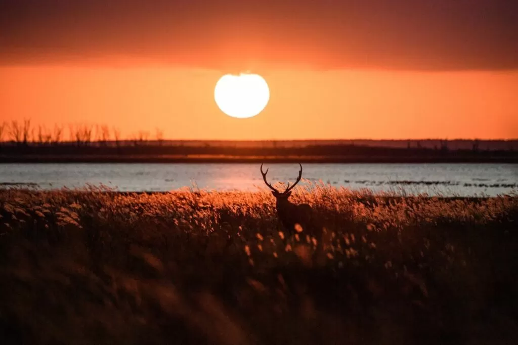
Yezo deer jump out mostly from evening into the night
Collisions with Yezo deer happen in large numbers across Hokkaido every year. A collision is hard enough to wreck the front of a car. Deer jump onto the road especially after sunset, at night and in the early morning, and the basic rule is to slow down in sections with warning signs.
The risk is highest in Shiretoko, eastern Hokkaido and northern Hokkaido. If you see a deer while driving, always slow down and check your surroundings before passing.
Refuel when the tank drops to half or below
In eastern and northern Hokkaido there are stretches where gas stations are dozens of kilometers apart. If you think “I’ll fill up in the next town,” you risk running out of fuel. It is safer to make a habit of refueling once the gauge falls below half.
Before heading toward Cape Soya or Shiretoko in particular, always fill the tank in a nearby town beforehand (in Wakkanai city, in the town of Shari, and so on).
Mountain pass weather is a different story from the lowlands
On inland pass sections such as the Hidaka Mountains, the Daisetsuzan range and Shiretoko Pass, there can be fog, rain or snow even when the lowlands are sunny. The Shiretoko Cross-Country Road (National Route 334 over Shiretoko Pass) in particular is at 738 m, and on foggy days even in summer visibility can drop to almost nothing. Before you go, check road conditions on the Hokkaido Regional Development Bureau’s road information.
Out-of-range areas are common in eastern and northern Hokkaido
In mountain and peninsula areas there are sections with no mobile signal. Downloading Google Maps offline maps beforehand, or carrying one paper road atlas, works as insurance. Before heading toward Shiretoko or Cape Soya, be sure to download the maps.
With a campervan, the route constraints go away
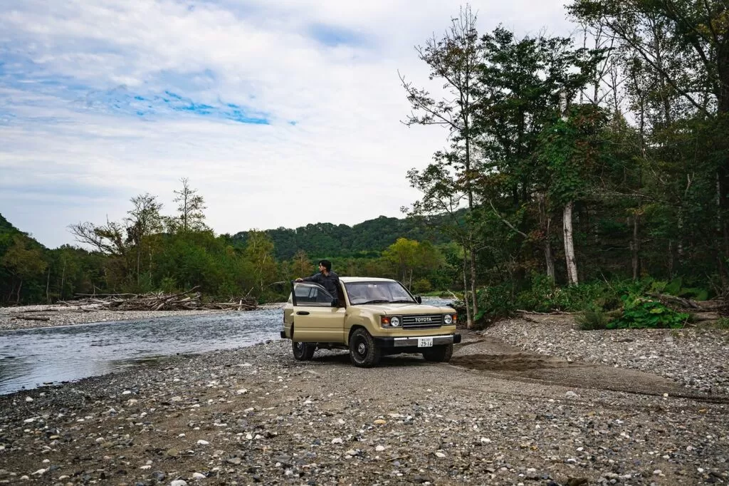
One of the troubles with driving in Hokkaido is that the location of your lodging ends up deciding your route. Even when you think “I’d like to keep looking at this view a little longer,” it often happens that you hurry to the next destination to make your booked lodging in time.
With a campervan, those constraints disappear. You can stay overnight wherever you arrive, at a Michi-no-Eki or RV park, so you can spend time in the places you like. You drive with all your luggage on board, so there is no need to shuttle between lodging and luggage.
It suits a drive around Hokkaido (about 2,090 km and a minimum of 12 nights and 13 days at up to 200 km a day) of course, and also trips like Furano and Biei where you want to stay in one place and take it slowly. See also the 1-week cost simulation.
New Chitose Airport / Tokachi-Obihiro Airport
Rent the Cabcon “Cresson Journey”
Base yourself at New Chitose Airport and compare rates, vehicle types, and pickup locations all in one place.
See details at Moving Inn →FAQ
How many days do I need for a drive in Hokkaido?
If you limit yourself to southern and central Hokkaido (Hakodate, Niseko, Furano, Asahikawa), 3–4 days is enough to see the main spots. If you add eastern Hokkaido (Kushiro, Shiretoko), plan for 5–7 days. For a loop of all the areas, 10 days or more is a guide.
What license do I need to drive in Hokkaido?
For driving a regular passenger car or rental car in Hokkaido, a standard license (including automatic-only) is fine. Campervans can also be driven with a standard license if they are Vancons or Kei-campers. For details, see the license guide.
When is the best season for driving in Hokkaido?
For first-timers, we suggest May–June (fresh green, fewer tourists) or September–October (autumn colors, uncrowded). Summer (July–August) is the peak for scenery, but lodging and crowds are concentrated then. In winter, studless tires and being used to snowy roads are a prerequisite.
How many days does it take to drive around Hokkaido?
Keeping to 200 km a day (this site’s guideline), a loop from New Chitose Airport comes to about 2,090 km and a minimum of 12 nights and 13 days. If you add sightseeing or spare days, add more days. For a more detailed schedule, the “6–7+ nights: Hokkaido loop course” in the Complete Guide to Hokkaido Campervan Model Courses lets you check each day’s overnight parking spots.
Can I drive while sleeping in a campervan?
Yes. Hokkaido has 128 Michi-no-Eki roadside stations, and at many of them campervans can park and take a nap. If you use an RV park, you can also get electric hookups. By sleeping in your vehicle as you go, you can change your route freely without being tied to lodging reservations.
Summary
- The main cities in Hokkaido are farther apart than you would expect. Keep each day to 200 km or less (this site’s guideline)
- Combine routes from 4 areas: central Hokkaido (Shakotan, Niseko, Lake Toya), northern Hokkaido (Furano, Biei, Wakkanai), eastern Hokkaido (Shiretoko, Kushiro, Okhotsk) and southern Hokkaido (Hakodate, Onuma)
- Check 3 things before you set out: Yezo deer, refueling spots and out-of-range areas
- The easiest seasons for driving are May–June and September–October. Summer is the peak and crowded
- With a campervan, you can change your route freely without lodging constraints
This page collects the campervan rental companies, rates and reviews available in Hokkaido.
Book a Campervan in Hokkaido
Moving Inn New Chitose Airport supports English booking and offers airport transfers.

![When and Where Can You See Harbor Seals at Cape Erimo? Kaze no Yakata Official Information, Viewing Season, and Windy-Day Notes [2026-27]](https://hokkaido-campingcar.jp/wp-content/uploads/2026/10/erimo-cape-lighthouse-768x511.jpg.webp)
![Where and Under What Conditions Can You See Diamond Dust in Hokkaido? How Cold a Morning It Takes, and Where It Appears [2026-27]](https://hokkaido-campingcar.jp/wp-content/uploads/2026/10/hokkaido-diamond-dust-nayoro-768x512.jpg.webp)
![Can You Drive to Hokkaido Jingu for Hatsumode? Parking, Crowds, and Where to Park and Walk [2027]](https://hokkaido-campingcar.jp/wp-content/uploads/2026/10/hokkaido-jingu-winter-torii-768x504.jpg.webp)
![Hokkaido Roads Over New Year [2026-27] | Expressway Sections Prone to Blizzard Closures, Forecast Congestion Days, No Holiday Discount, and New Chitose Airport Parking](https://hokkaido-campingcar.jp/wp-content/uploads/2026/10/hokkaido-winter-rural-road-edge-markers-768x432.jpg.webp)
![Where to See Sea Smoke (Kearashi) in Hokkaido: Rumoi’s Ogon-misaki and the Morning Conditions [2026-27]](https://hokkaido-campingcar.jp/wp-content/uploads/2026/10/rumoi-kearashi-sea-smoke-768x511.jpg.webp)
![Geminid Meteor Shower 2026 in Hokkaido: Peak Around 23:00 on December 14, Sapporo Moonset 20:40, and Staying Warm in a Winter Campervan [2026]](https://hokkaido-campingcar.jp/wp-content/uploads/2026/10/geminids-2026-hokkaido-768x575.jpg.webp)
